

Central Otago's famous for its Pinot Noir and valley-slash-hilly grape growing terrain. But it's rugged landscape totally delivers on the walking front too. We've included the best hikes - from fifteen minutes to stretch your folded limbs, to dusting off the boots and marching somewhere mighty for four hours, like Rob Roy.
Remember, before embarking on any walk: plan your trip, check the weather, tell someone where you're going and take gear including water, food, warm clothing, jacket, torch, basic first aid kit and a map of where you're walking. To ensure you have an awesome adventure, check out these interactive guides from the NZ Mountain Safety Council.

Sunshine Bay Track
Queenstown to Sunshine Bay Walk 1 hour return.
If you’re looking for a nice, hour long (round trip) walk, take the track from the eastern end of Queenstown heading out towards Sunshine Bay. The slightly rough but reasonably maintained schist and dirt track meanders along beside Lake Wakatipu under a canopy of trees which arch over the track.
The walk itself is not too taxing, but can get a little slippery if there has been rain. There are a couple of look out spots for you to soak up the glorious views of the Lake Wakatipu, framed by snow capped mountains, and do keep your eyes peeled for bell birds, tuis and kereru singing and dancing amongst the trees. You can walk for 10 minutes to the little bridge over the tinkering waterfall, or stop in at Raewards Fresh Market before you go, pick up picnic supplies and take the half hour walk to Sunshine Bay where you will more than likely be the only ones on the pebbled beaches. Skim stones, wander to the rocky end of the beach or simply sit and chill out to the sound of the waves lapping up on the beachfront.

Lakes Hayes Walkway
Lake Hayes walk - 1.5 - 2 hours circumnavigation.
Lake Hayes, the mirror lake, where on a clear, fine day it’s difficult to determine which way is up on your photograph. To really get a sense of the lake as a whole, a wonderful option is to circumnavigate it. The DOC track is a well maintained, undulating dirt track that frames the lake. Start at the campground, checking out the schist beach with it’s rabble of mallard and blue ducks who hang out with some very regal looking swans. The track winds around the willow-clad campground and gently onto the hillside where you become the spectacle of some very precariously perched high country sheep. There has been some extensive planting of kowhai trees on this side of the lake, which in several years will colour the lake edge a glorious bright yellow, a few months each year. The other plus of this great native planting is that it will attract the tui back to this 7.8km walk.
There are several look out points where walkers can rest and inhale deeply whilst taking in the glory of lake and mountain views. The Southern end of the lake is a wetland so the walk proceeds along a reasonably new boardwalk (with meshing to help prevent slipping when it’s wet and icy) taking you back onto the track, which wends along between the houses and the lakefront back to the campground.

Macetown Walkway
Macetown was first settled in the early 1860s as a result of the discovery of gold in the Arrow River. At first the rush was for alluvial gold but later the miners turned their attention to the hills where several quartz mining operations were established. When the gold ran out, the town slowly died and by the 1930s, Macetown was just a ghost town. There are two ways to get to Macetown, the track up and over Big Hill or along the scenic Arrow gorge. The latter, described here, is a 15km, easy route, a combination of a 4WD road and foot-track that follows the Arrow River.
In summer, set off early to avoid the midday heat, taking sun protection, water and lunch. In winter, check the track and road conditions, especially after snow or heavy rain which can make the route impassable as there are numerous river crossings.
The foot-track and 4WD road both begin in Bush Creek, a small tributary of the Arrow River. The foot track climbs up and around a hillside, high above the vehicle road, thus avoiding several river crossings. It follows an irrigation pipeline, passing through dramatic schist pillars and crossing a shallow stream and picturesque waterfall with conveniently-placed stepping stones. The views of the river and the steep-sided gorge are spectacular in all seasons but in autumn the poplars are golden-leaved and the hillsides are ablaze with colour.
After 20-30 minutes, the foot track descends steeply, crosses the Arrow on a newish bridge and joins the 4WD road. There’s a steady climb to Britannia Terrace where you will see mine tailings and the ruins of old stone cottages. Look down to Scoles Tunnel where the Arrow River was diverted so gold miners could work the river-bed in the 1860s. In summer, stop on the way to pick tart gooseberries and sweet raspberries growing wild on the side of the road, and smell the sweet pastel-coloured lupins which flower profusely in at this time of year. You might also see geckos sunbathing on the rocks.
Further on, an ancient slip has blocked the valley creating the Arrow Falls above which is the intake for the Arrow Irrigation Scheme.
The river bends to the left and the road meanders up the gorge passing an old homestead and abandoned water races. The Big Hill Track joins the road at Eight Mile Creek and soon after you enter Macetown Historic Reserve. The old township site is further on at Twelve Mile Creek.
Very little remains of the once-thriving township, established in 1864 and named after three gold-mining brothers, John, Charles and Harry Mace. A bakehouse and an original cottage belonging to the Needham family have been well-restored, and the remnants of a main street can be seen along with crumbled stone walls and fruit trees where cottages once stood. Daffodils still appear in the spring, a reminder of flower gardens planted long ago.
It’s a peaceful place nestled among the hills and you can easily visualise the townsfolk walking up and down the main street, children tarrying on their way to school and miners setting off to the river in search of gold.
While most of the gold extracted from Central Otago was alluvial, three quartz-crushing batteries operated beyond Macetown. The most accessible by foot is the well-restored Anderson's Battery about 15 minutes from Macetown where the road ends. It’s the only known all-metal stamping battery in Otago and well worth the extra distance.
On the return trip late in the afternoon, the cold river water on the sun-warmed schist has a distinctive yet indescribable smell, and the river silt leaves a shimmery silver powder on your skin. The play of light on the golden tussocked hills and the dark shadows cast by the high mountain ranges and deep gorges is magic. It’s a long day but there is a basic camping ground at Macetown if you want to stay a night and do the walk over two days.
- Before walking to Macetown, visit the local museum to learn about the colourful history of the region. Also explore the restored huts and store at the Arrowtown Chinese Settlement on the banks of Bush Creek. Chinese immigrants lived here during the gold rush era.

Blue Pools Track
1.5km, 30 minutes return.
Ten kilometres beyond Haast Pass on SH6 en route to Wanaka is the easy, 1.5km, 30-minute (return) beech forest walk to the beautiful Blue Pools where the Makarora and Blue Rivers meet. An information board at the viewing platform overlooking the series of deep pools informs hikers that the intense blue colour is the result of light refraction on the clear, glacier-fed, ice-cold water. The water also looks startlingly green in some lights and is so clear you can see brown and rainbow trout swimming about. It’s an ideal spot to stop and stretch your legs on the road trip from the West Coast to Wanaka. A great walk for children with the added excitement of crossing a swing bridge over the Makarora River.

Routeburn Track
The Routeburn Track is where many an addiction to tramping begins. The two or three-day 32-kilometre track, one of New Zealand’s nine Great Walks, is unbelievably beautiful. You can get a taste of it by starting at the Glenorchy end of the track and walking to the Routeburn Flats DoC hut, the first of 4 on the track.
Take time to read the fascinating information boards at the Routeburn day shelter at the start of the track and then set off on a gentle but steady climb on a wide track alongside the crystalline Route Burn stream. Walk in dappled sunlight through a forest of palest green-leafed beech trees in the company of friendly fantails and bush robins flitting from branch to branch nearby.
Cross two swing bridges and stop on a sunny mossy bank by a deep turquoise pool for a snack and chat to other trampers from all corners of the globe. Have lunch at the sunny, grassy clearing near the Routeburn Flats Hut or under shelter if it’s raining and then return to the carpark, or continue to the Routeburn Falls Hut. This part of the track is significantly steeper and more challenging but with every step, the landscape unfolds to reveal stunning views of waterfalls, lakes, rivers, snowy alpine peaks and glacier-carved valleys. After heavy rain, the silver-grey rockface towering above the hut turns into a waterfall. Sometimes the wind is so strong, the waterfall is blown back uphill creating a bizarre spectacle. Then walk a little further to the awesome Routeburn Falls cascade. You can turn back here or stay a night at the Routeburn Falls DoC Hut (this needs to be booked well in advance) and continue on to the 1255-metre Harris Saddle where you will be rewarded with a breathtaking panorama of the snow-capped Darran Mountains towering above the deep, dark Hollyford Valley with the shimmer of the Tasman Sea far beyond.
And as you walk the Routeburn, remember you are treading in the footsteps of the ancient Maori pounamu, or greenstone, route between Wakatipu and the West Coast around 500 years ago.
The magnificent 46km road along the edge of Lake Wakatipu from Queenstown to the start of the track is rated one of the top ten scenic drives in the world and the view of Lake Wakatipu and the mountains from Bennett's Bluff Lookout is among the most photographed in New Zealand.

Waterfall Creek Walkway
2.5km one way.
The 2.5km walk from Wanaka to Waterfall Creek (or vice versa) is easy to access, flat and push-chair friendly which makes it possibly the most heavily-walked stretch of the whole lake. The track has many ‘wow-worthy’ sights along the way - it passes the absurdly-famous Wanaka tree with its adoring fan club of international photographers jostling for killer angles then skirts the manicured lawns of the Edgewater Resort with its millionaire holiday home neighbours and the picturesque vineyards of Rippon Winery. Sit under the willow tree on the beach at Waterfall Creek and admire the jewel of the lake, Ruby Island, a 3 hectare public reserve accessible only by boat.
Wedding parties often pose for photos on the lakeshore so you can watch the extreme lengths some couples go to get that perfect image to frame.
If you have time for no other walk in Wanaka, do this one. And you can stop for coffee at Edgewater or wine at Rippon.

Mount Iron Track
60-80 minutes, 4.5km.
Walking up Mt Iron before breakfast, often with a canine companion or two in tow, is a popular tradition for Wanaka-ites. Just 2km from the centre of the township, it's impossible to invent excuses as to why you should not climb the hill as part of time on holiday in one of Aotearoa's most beautiful mountain villages.
The wedge-shaped rocky knoll known as a ‘rôche moutonnée’ (or sheepback) was carved by mighty glaciers during the last Ice Age 10,000 years ago. There are several access points to the 60-80 minute, 4.5km loop track which can be tackled from an eastern or western direction. The most popular way is to ascend the longer, more gradual slope of the wedge and descend by the shorter steeper side.
The lower part of the track is clay and shingle but there are some steep, gnarly, rocky stretches near the top on both sides. A wooden staircase with hand rails makes the descent a bit easier.
Either way, scaling the 250m hill is physically challenging and your calf muscles will be complaining thereafter . . . but you can take it easy for the rest of the day.
There's a 2.7m-high steel statue of a shepherd and his dog near the foot of the hill to commemorate the fact that Wanaka held the world's first ever recorded dog trials in 1867.
As you climb, you will probably see the fluffy white tails of rabbits as they scamper across the hillside. They may look cute but they are the reason there’s a complete absence of grass on Mr Iron.
At the top, the 360 degree panorama of Lake Wanaka, Mt Aspiring National Park and the Southern Alps/Kā Tiritiri o te Moana is absolutely magnificent. The lake shines like a jewel enclosed in a mountain necklace. A map of the horizon cast in bronze names all the mountains but there are so many, it’s incredibly hard to memorised them all. You can also see Wanaka’s sister, Lake Hawea, sparkling in the distance. She’s more remote and less populated than Wanaka but just as beautiful.
After summiting Mt Iron, Wanaka-ites usually gather for scrumptious date or cheese scones and coffee at Fed Diner, or later in the day, sip a local rosé on the lakeshore.
Please note, the kanuka shrubland offers little shade or shelter, especially on the ascent and at the summit, so take sun protection in the summer and warm clothing in the winter. In addition the wind can be fiercely cold at the top in the winter months and the track is likely to be slippery after rain, frost or snow.

Rob Roy Glacier Track
Rob Roy Glacier, Mt Aspiring National Park (Te Wahipounamu UNESCO World Heritage site - known to the original Māori inhabitants as the Greenstone Waters.)
The hour-long, 54km drive from Wanaka to the start of the Rob Roy Glacier track is a highlight in its own right. The road skirts Lake Wanaka, passing by iconic Glendhu Bay with postcard views of Mt Aspiring and the wispy waterfalls of Treble Cone.
The 10km track from the Raspberry Creek carpark to the Rob Roy Glacier lookout and back takes about 3-4 hours.
The hike to the glacier is stunning in all seasons - in high summer under a sun-bleached sky, in mid-winter as fat snowflakes drift down from slate-grey clouds and even in the rain, when waterfalls cascade from the cliffs above. But the primo time is on a sparkling clear day after a hoar frost when your boots crunch through stiff white tussock. You will need walking sticks at that time of the year because of ice and snow.
The track starts with an easy amble up a wide valley along the banks of the Matukituki River. You cross a suspension bridge over the river where the water is ice-green. The track then heads up a steep-sided gorge alongside Rob Roy stream. Icicles droop from overhangs and the air sparkles with diamond frost filaments in the winter sun. The track is steep in places but glimpses of the glacier through the rainforest canopy spur you on.
The last part of the track to the lookout is above the tree line and takes walkers around truck-sized boulders discarded by the glacier as it retreated up the mountain side to its present-day home, clinging to a rock face below Rob Roy Peak. Under a heavy mantle of snow, the cold blue gleam of the glacier face is blindingly bright and mesmerizingly beautiful.
In the spring and summer thaw, huge slabs of ice on the terminal face lose the fight against gravity and thunder down the valley in a white cloud . . . an awesome sight and sound from the safety of the lookout. It gets very cold up there during the winter months so you don’t want to linger long at this high altitude. You need to wear warm clothing, hats, gloves and sturdy boots.
In the summer, take a picnic lunch and sit among the tussocks to enjoy the view of the glacier, waterfalls, alpine flowers and the kea, New Zealand’s cheeky mountain parrot who will help himself to your lunch if you look the other way.
The descent to Raspberry Creek carpark is tricky because although you are walking forwards you’ll find yourself looking backwards for fear of missing a view you may not have seen on the way up. On the drive back to Wanaka, stop at the tiny pebbled beach near Glendhu Bay to watch the winter sun slide behind Mt Aspiring/Tititea in a blaze of fire . . . and store memories until next time.

Glendhu Bay Track
Glendhu Bay Track/Millennium Track, Wanaka. 12.5 km one way from Glendhu Bay carpark to Waterfall Creek carpark; 15km one way from Glendhu Bay carpark to Wanaka.
The Millennium Track from Wanaka township to iconic Glendhu Bay is an absolute stunner. Also known as the Glendhu Bay Track, the well-formed pathway weaves its way up and down along the lake edge past a string of sheltered pebbled coves, all competing for the-most-beautiful-beach prize.
The track can be walked in either direction but you will need to find an obliging friend or taxi to provide a drop-off or pick-up service. Option one is to be dropped off 15 minutes along the Wanaka-Mt Aspiring Road at Glendhu Bay and ask to be collected at Waterfall Creek carpark on Ruby Island Road where there is road access down to the lake edge. That’s a 12.5km walk and takes a good three hours, depending on the number of beaches you stop at to take photos. Alternatively you can walk the flat and easy 2.5km from Waterfall Creek back to Wanaka township (see Waterfall Creek Track). Option two is to start from Wanaka township and arrange a pick-up at Glendhu Bay. Either way, you are rewarded with glorious, heart-soaring views of the lake and mountains.
The track is suitable for all ages and levels of fitness. Between Waterfall Creek and Glendhu Bay, there are several steady climbs around headlands and bluffs where the track has been blasted into the bedrock providing a fascinating geological cross section into the structure of the land and the thin layer of soil on top of rock. The views from these vantage points high above the lake are astonishing, especially snow-clad stellar Mt Aspiring/Tititea standing proud and regal at the far end of the lake.
Wanaka is a lake of many moods – on a calm day, the surrounding mountains are perfectly reflected in the satin water but a storm can turn the lake into a wild, choppy sea of whitecaps within minutes. Dramatic to watch from the shore but notoriously treacherous for boaties.
In summer, the track is bordered by a riot of pastel-coloured lupins; the winter hoar frost turns the tussock into silver fronds that sparkle in the sunshine. All seasons have beautiful, unique faces. At weekends, you will often come across community-minded Wanaka residents planting and tending native trees along the verges of the track. There are water tanks and buckets along the way so walkers can help keep plants alive during the dry season.
Take a picnic and swimwear with you in the summer and stop for a bracing dip at exquisite Damper Bay. The water temperature of the lake is 8-10 degrees Celsius year-round so be prepared for a refreshing experience. The track is wide and well-maintained, easily handled with walking shoes, but please do watch out for speeding mountain bikers who also love this track. And as always in New Zealand, take sun protection in the summer and warm clothing in the winter.

Blue Lake Walks
This 2 km loop track encircles the historic, man-made lake. It's a great opportunity to walk past old sluicings and the remnants of the goldmining equipment that was used here - machinery that literally converted Kildare Hill into a lake. You will never see water so blue or so perfectly still.
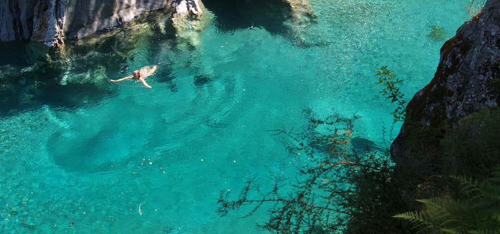
Banner Photo Credit: Flickr - Tomas Sobek
Explore More Trip Guides
- Trip Guide
Wellington's Best Walks
- 18 Places
- Trip Guide
West Coast Region Walks
- 10 Places
- Trip Guide
Southland Region Walks
- 5 Places
- Trip Guide
Central North Island's Best Day Walks
- 6 Places