

Here are six walks in Southland to get your wanderlust on from a half day in the Keplar to exploring the wonder that is Stewart Island.
Remember, before embarking on any walk: plan your trip, check the weather, tell someone where you're going and take gear including water, food, warm clothing, jacket, torch, basic first aid kit and a map of where you're walking. To ensure you have an awesome adventure, check out these interactive guides from the NZ Mountain Safety Council.

Mavora Lakes
South Mavora Lake Walking Track : 2 hr 30 min
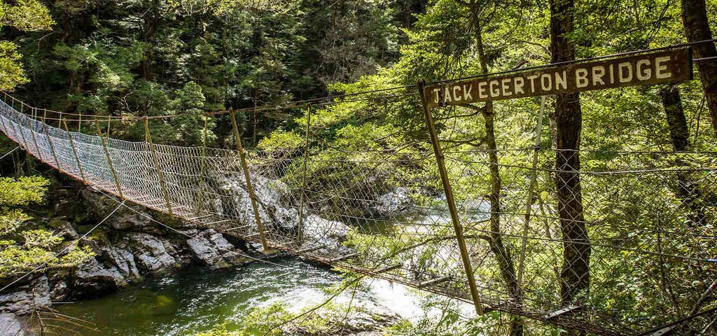
The track starts over the swingbridge near the camping area. It follows the Mararoa River downstream and around the shores of the South Mavora Lake, to the swingbridge at its outlet. An umarked route used by anglers also follows the shores of the North Mavora Lake for about an hour.
Lake Mavora to the Kiwi Burn Hut : 4 hr
This track is suitable for families. There are two entry points to this walk. The first crosses the swingbridge at the outlet of South Mavora Lake and travels down the true right of the Mararoa River for 2 hr 30 min. Here it joins with the other access point, signposted on the Mavora Road, 1.5 km from Hikuraki Station.
The next segment of the track to the Kiwi Burn Hut takes about 1 hr 30 min, following the Mararoa River downstream then branching to the hut. The track then continues past the hut, returning to the swingbridge.
Getting there You can access these walking tracks from the Lake Mavora camping ground in the Mavora Lakes Conservation Park.
Access to Mavora Lakes is off of SH94 between Mossburn and Te Anau. There are signposted turn off points at Centre Hill or Burwood Station. Then follow gravel roads for 39 km.
Please note, there are no regular transport services to the Mavora Lakes in winter.

Waituna Lagoon Tracks
10 m - 2 hr, easy walking track. (Please note, no dogs allowed.) View detailed map About this track
Waituna Lagoon Boardwalk. (10 mins) The boardwalk winds through low-growing manuka and shrubs, emerging at a viewing shelter that overlooks Waituna Lagoon. Interpretation panels in the shelter provide a wealth of information on the area and its fascinating inhabitants.
The lagoon is periodically open to the sea and its brackish waters are an important habitat for wildfowl, native fish and trout. The viewing platform is a good spot for viewing wildlife.
There is a toilet and picnic table at the carpark at the start of the Boardwalk Track.
Wetland Loop Track - 1-1.5 hr return, 5 km loop track
This wetland loop track starts on the Boardwalk Track. The first intersection onto the Wetland Loop Track is approximately 50 m from the start of the Boardwalk Track at the carpark. The wetland Loop Track is easy walking on both boardwalk and gravel through manuka wetland and past bog tarns.
There are great interpretation panels and rest stops along the way. Listen carefully for fernbirds. This loop track links onto the Boardwalk Track and the viewing platform and will then lead you back to the carpark.
Waituna Quarry Restoration Track - 5 min return - 300 m return
There is a carpark for this track situated on the corner of Waituna Lagoon Road and Hanson Road. This former gravel pit quarry is an active restoration project. The Waituna Landcare Group is transforming the gravel pit into a functioning wetland. There is short gravel track to a viewing point overlooking the pond and an interpretation panel identifying wetland inhabitants.
The Waituna Lagoon Outlet site can be reached on foot along the beach or by small boat or kayak via Waituna Lagoon at high tide when Waituna Lagoon outlet is open, or anytime when outlet is closed to the sea.
Beach access You can also access the spectacular, white quartz beach off Waituna Lagoon Road. There is no track but you can walk along the beach. The entire walk is 4-5 hr return (9 km one way) from the eastern end of Waituna Lagoon to Waituna Lagoon opening site
The beach walk begins with a gentle climb over a loose gravel bank. Once on the beach walking is easy and can be as long (or short) as you wish.
Don't take vehicles onto the gravel as the gravel is deep and you will get stuck.The gravel is thick and may be sloping and difficult to walk on. And do be aware of tides and sea conditions. The gravel beach area is quite steep in places and is exposed.
The Waituna Lagoon is sometimes opened to the sea and the lagoon becomes tidal. You will only be able to walk on the beach up to the site where the lagoon is opened to the sea.
Getting there Waituna Lagoon is situated 40 km south east from Invercargill at the end of Waghorns Road. Access to the walking track is off the Southern Scenic Route via Waituna Lagoon Road and then Waghorn Road.
Boat ramp access is at two locations: Moffat Road and the corner of Waituna Lagoon Road with Waghorn Road. Waituna Lagoon may not be very deep and may also be tidal so be aware of channels for boat access.
Trippers tips : Waituna Lagoon is situated on the southern coast of Southland, so please be prepared for exposed weather conditions. The lagoon is sometimes open to the sea so you need to be aware that it may be tidal which can limit both boat and foot access to the lagoon opening site. If accessing the coastal beach area the surf can make the beach quite steep and narrow. The beach is not recommended for vehicle access. There is no camping is allowed. And please do not light any fires when visiting the wetland or lagoon. Even though by nature wetlands are wet they burn very easily. In the past fires have swept through hundreds of hectares of the wetland and decades later the vegetation still has not recovered.

Piano Flat & Waikaia Forest Tramping Tracks
Waikaia Forest, home to four unique invertebrates, is a large island of beech forest, nestled in the mountain farmlands of northern Southland. Piano Flat, a grassy enclosure at the southern end, provides a picnic area, camping ground and several walking tracks. Popular recreational pursuits in the area include horse riding, trailbike riding, trout fishing, hunting, walking and four-wheel drive excursions. Several private cribs (holiday homes) are located here. As a result of the Ngāi Tahu settlement with the Crown, a nohoanga (meaning 'a place to sit') entitlement is located here. This gives Ngāi Tahu people exclusive camping rights to access customary fishing areas and gather other natural resources. However, this does not affect public access.

Oban Day Walks
Observation Rock : 30 min return from the Rakiura National Park Visitor Centre
This walk is almost entirely on sealed roads and is suitable for buggies. Although a steep walk, your efforts will be rewarded with panoramic views over Paterson Inlet/Whaka a Te Wera and, on clear days, views of Mount Anglem/Hananui and Mount Rakeahua. Observation Rock is also a superb place to watch sunrise, sunset and if you are lucky to time it right - an aurora australis display.
Getting there: From the Rakiura National Park Visitor Centre, head towards the waterfront, turn right, walk along the waterfront and take the next right turn (Ayr Street). Follow the road over the brow of the hill then branching up to the left into Leonard Street. Follow the road as it bends to the left becoming Excelsior Street. Look for the Department of Conservation signpost marking the short path to Observation Rock.
Bathing Beach : 30 min return from the Rakiura National Park Visitor Centre
This short walk takes you along both road and track, both can sometimes be steep. Bathing Beach is a popular and sheltered swimming area with a white-sand beach - great for kids. The adjacent Mill Creek estuary is an interesting place to explore at low-tide, with remnants of timber from early milling days still visible along the creek edge. This track is maintained by the Southland District Council.
Getting there: Turn left at the Halfmoon Bay waterfront. Walk past the general store and turn right just as you start to climb the hill into Kamahi Road and follow this around until reaching the Bathing Beach signpost.
Halfmoon Bay Cemetery : 45 min return from the Rakiura National Park Visitor Centre
The Halfmoon Bay cemetery offers an insight into the lives of some of the early settlers on the island, while providing stunning views out over the Mill Creek estuary. A classic insta opportunty!
Getting there: At Halfmoon Bay turn left and walk past the general store and uphill on the Horseshoe Bay Road. Just after crossing Mill Creek bridge, turn left into Mapau Road, and follow this road until turning left at the cemetery signpost.
Fuchsia and Raroa walks : 1 hr return from the Rakiura National Park Visitor Centre
These well-formed bush tracks are suitable for children, however there are sections of steps so it's not suitable for buggies. Return via the road or back on the same track.
Just five minutes walk from the waterfront at Halfmoon Bay lies an area of rich natural forest untouched by early milling operations. Two tracks run through this section of scenic reserve, which was gifted to the Government in the 1960s by Captain George Turner as he recognised the importance of protecting walks in the vicinity of Halfmoon Bay that had been undamaged by early milling or land clearance.
The tracks takes you past 500-year-old rimu, lush ferns, vibrant mosses and New Zealand tree-fuchsia. During summer months this area of forest is alive with the chorus of bellbird/korimako, tūī, wood pigeon/kererū and kākā.
Getting there: Turn left outside the Rakiura National Park Visitor Centre and left again into Dundee Street. The Fuchsia Walk is signposted about 100 metres on your right over the brow of the hill. The track climbs steadily up to Traill Park. From here, continue diagonally across the park and to the start of the Raroa Walk. This 15 minute track takes you to Watercress Bay and Thule Road. Return via the road to Golden Bay and Halfmoon Bay or walk back along the same track.
Moturau Moana : 1 hr return from the Rakiura National Park Visitor Centreand is suitable for buggies.
Moturau Moana translates as “islands of bush above the sea” and is an area of mostly native garden gifted to the people of New Zealand by the late Noeline Baker. Miss Baker collected the plants from Stewart Island/Rakiura and on field trips to the South Island. Today these gardens provide a peaceful setting with views over Halfmoon Bay.
Getting there: At the waterfront, turn left into Horseshoe Bay Road and continue over Mill Creek and past Butterfield Beach until the Bragg Bay turnoff. The entrance to Moturau Moana is a few minutes along this road on the left. Return the same way or take the longer walk round Horseshoe Point.
Evening Cove : 1 hr 30 min return from the Rakiura National Park Visitor Centre
At the Halfmoon Bay waterfront, turn right and follow the coast road until you arrive at Leask Bay. Here you will find relics of the whaling days. From the bay, turn right into Evening Cove Road and follow this road until the end where a five minute track leads down to a peaceful and secluded beach.
Lonnekers Beach – Ringaringa Beach : 1 hr 30 min return from the Rakiura National Park Visitor Centre
Lonnekers Beach can be accessed by buggies and the rock pools at the eastern end (30 min) will keep kids entertained.
At the Halfmoon Bay waterfront, turn right and follow the coast road to Lonnekers Beach. A track begins on the opposite side of the road, approximately halfway along the beach. The walk goes to Ringaringa Beach and the northern edge of the golf course. From Ringaringa Beach you may return the same way or follow the old Ringaringa Road to Leask Bay.
Golden Bay - Deep Bay - Ringaringa – Wohlers Monument - Peterson Hill : 1 hr 30 min - 2 hr return from the Rakiura National Park Visitor Centre
This well-graded walk is suitable for walking children. With some steep sections of steps it's unfortunately not suitable for buggies. However, the delightful well-formed Golden Bay bush track winds, climbs and falls along the coastal fringe, providing scenic views of Paterson Inlet/Whaka a Te Wera and Ulva Island/Te Wharawhara. Further along, the road above Ringaringa Beach leads to a track to Wohlers Monument and views of Native Island. Returning via Peterson Hill allows lovely views of Halfmoon Bay. Parts of this walk are along the road but much is in forest, providing some protection on windy or rainy days.
The monument to Reverend Wohlers, an early missionary, is situated just a short walk from the road end beyond Ringaringa Beach. From the end of the track you get good views out over Native Island and the inlet. To return to Halfmoon Bay, walk back along the road past Deep Bay and up the hill for a short distance, until you find a track on your left though Deep Bay Reserve and over Peterson Hill.
Getting there: From the Rakiura National Park Visitor Centre, walk to the water-front, turn right and then right again into Ayr Street. Follow this street (which becomes Golden Bay Road) for about 10 minutes, passing Traill Park before heading down-hill. On your left, just before Golden Bay, you will see a sign marking the start of the Golden Bay Track. At the Deep Bay end of the track the beach may be explored. Continue straight ahead along the road to Ringaringa, with the golf course on your left, and follow the road as it veers right along cliffs above the beach.
Fern Gully : 2 hr return from the Rakiura National Park Visitor Centre
Walk through regenerating native bush - with a picnic area at the furthest point, this is a great option for children and is suitable for buggies.
Starting along the road, this is easy walking but the track can be muddy. It follows an old sawmill track, winding along a stream flanked by beautiful ferns and cutover forest. A clearing and seat at the end of the track provide a pleasant spot to enjoy the birds and forest. Fern Gully was one of the places local residents planned to hide their children in the event of an invasion during the Second World War.
The route follows an old sawmill track, winding along a stream flanked by beautiful ferns and cutover forest. A clearing and seat at the end of the track provide a pleasant spot to enjoy the birds and forest. Return the same way or add on the longer walk via Ryan's Creek.
Getting there: Turn left outside the Rakiura National Park Visitor Centre and continue along Main Road. Turn right at the airstrip turnoff and continue along Kaipipi Road until reaching the signpost marking the start of Ryan's Creek, Fern Gully, Kaipipi Bay and North Arm tracks.
Harrold Bay and Acker's Point : 3 hr return from the Rakiura National Park Visitors Centre
A scenic walk along the road, followed by five minutes along a well-formed track crossing private land, takes you to picturesque Harrold Bay, where one of the oldest buildings in New Zealand is located. Venture inside the stone house, built by Lewis Acker in approximately 1835, and imagine life here with his eight children.
Further on, at the end of the track you reach Acker's Point, where the panoramic views out over the islands and Foveaux Strait are great reward. In mid-late summer tītī (sooty shearwaters/muttonbirds) can be seen returning to their burrows around this point at dusk and little blue penguins/kororā after dark. A lighthouse used to be situated across the inlet mouth at The Neck but was shifted to the present site in 1927. This was replaced by the current Beacon in 2006.
Getting there: To get to Harrold Bay and Acker's Point, turn right at the Halfmoon Bay waterfront and follow the coast road, passing Lonnekers Bay and Leask Bay, until you reach the stile at the end of the road marking the start of the track. Please respect the privacy of the landowner while visiting Harrold Bay. Continue along the main track through coastal forest until you reach the lighthouse at Acker's Point.
Kaipipi Bay : 3 hr return from the Rakiura National Park Visitor Centre
The walk to Kaipipi Bay takes you along an old logging road. The surface is still in reasonable condition considering all the traffic that has travelled along it. The walk is not strenuous but there can be muddy patches so suitable footwear is advised.
At the track end a small grassy clearing looks out over Kaipipi Bay, an enclosed haven on the north shore of Paterson Inlet/Whaka a Te Wera. The track continues on to North Arm Hut, part of the Rakiura Track Great Walk. Return the same way, or make a longer walk by turning off via Ryan's Creek.
Getting there: From Rakiura National Park Visitor Centre, turn left and follow Main Road. Take the right turn at the airstrip turnoff and continue along Kaipipi Road until reaching the signpost marking the start of Ryan's Creek, Fern Gully, Kaipipi Bay and North Arm tracks. Continue straight on here along the old logging road.
Ryans Creek : 3 hr 30 min – 4 hr return from the Rakiura National Park Visitor Centre
This is a good option for older children but is not suitable for buggies as it has some sections of steps and is quite narrow in places. There is a picnic area approximately half way - next to Ryans Creek, where at low tide you are able to view remnants of the logging that once occured in the area.
This circular walk begins along existing road, and follows old disused logging roads and undulating track through coastal vegetation. The track can be muddy in places. Ryans Creek track is accessible from either Thule Road end or Kaipipi Road end. From the coastal section, there are scenic views of Paterson Inlet/Whaka a Te Wera. Walkers can also see wading birds feeding on mud-flats at low tide at Vaila Voe Bay, about 15 minutes from Thule Bay.
Getting there: To walk the circuit anti-clockwise, from Rakiura National Park Visitor Centre, turn left and follow Main Road. Take the right turn at the airstrip turnoff and continue along Main Road until reaching the DOC signpost marking the start of Ryan's Creek, Fern Gully, Kaipipi Bay and North Arm tracks. Continue straight on until the DOC sign at the junction with the old Ryan's Creek road. Turn left for Ryan's Creek. From the picnic site at Ryan's Creek, the track follows the coastline, with Paterson Inlet on your right, back to the end of Thule Road. Follow the road back to Halfmoon Bay or return via Raroa Walk (on the left next to Rankin St) and across the rugby ground to Fuchsia Walk.
Horseshoe Point : 3–4 hr return from the Rakiura National Park Visitor Centre
Part of this walk includes road. The track round Horseshoe Point is undulating and mostly in good condition. Maintained by Southland District Council, it meanders along the coast from Bragg Bay, winding above secluded bays and crystal clear water. It descends steeply down to Dead Man Beach which, despite the name, is a pleasant spot to stop for a rest.
At the beginning of the track you can visit the lovely Motorau Moana Native Gardens and views of Halfmoon Bay are afforded from a comfortable bench on a wooden deck here. Horseshoe Point is about an hour’s walk from Bragg Bay and is an ideal place to view Foveaux Strait. From the point, the track passes under huge macrocarpa trees, remnants of a former homestead site, and eventually finishes at Horseshoe Bay.
The track emerges just past the entrance to the Resource Recovery Centre at the southern end of Horsehoe Bay. Turn left and return to Halfmoon Bay via the road.
Getting there: Follow Horseshoe Bay Road north for about 1½ km, turning into Bragg Bay Road just uphill from Butterfield Beach. The entrance to Moturau Moana is a few minutes along this road to the left.The Horseshoe Point track starts at the end of the road.

Ulva Island Walking Track
Explore this open sanctuary on well-formed tracks, catering for all ages and levels of fitness. Track times given below are return times from Post Office Bay but connected paths will allow you to return by a different route. Times are generous allowing for stops to listen to the birds.
Flagstaff Point Lookout : 20 min return to Post Office Bay
A short walk takes you up steps to the lookout with panoramic views back to Stewart Island/Rakiura. A flagstaff was erected here by Postmaster Charles Traill so he could signal to residents of Paterson Inlet/Whaka a Te Wera when the mail boat arrived from Bluff. You can choose to descend and return via Sydney Cove.
Sydney Cove Picnic Area : 20 min return to Post Office Bay
An easy walk brings you to this beautiful, golden sand beach where you'll definitely want to linger. Picnic tables, a picnic shelter, toilet facility and fresh water are available here. From the beach you'll look out onto part of the Ulva Island/Te Wharawhara Marine Reserve. Walking south along the beach, you'll find another track leading to the four-way junction that links this track with tracks to Boulder Beach, West End Beach and back to Post Office Bay.
Boulder Beach : 1 hr 30 min return to Post Office Bay
Boulder Beach takes its name from two massive boulders now hidden in the forest covering the southern ridge above. This sheltered beach also gives views west across the marine reserve to the tiny islands and distant shores of Paterson Inlet. A track leads from the north end of Boulder Beach to West End Beach.
West End Beach : 2 hr return to Post Office Bay
As you approach this most westerly of the island's beaches, the heavier forest of the island merges into coastal plant communities. The loop with the Boulder Beach track gives an easy round trip of about three hours.
Banner Photo Credit: Department Of Conservation
Explore More Trip Guides
- Trip Guide
Wellington's Best Walks
- 18 Places
- Trip Guide
West Coast Region Walks
- 10 Places
- Trip Guide
Otago's Amazing Day Walks
- 10 Places
- Trip Guide
Central North Island's Best Day Walks
- 6 Places