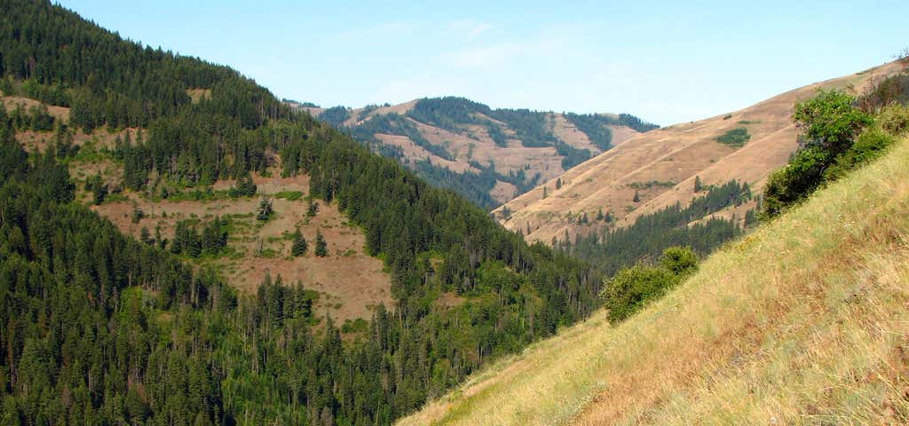

This trail is open to foot and horse traffic only since it is located within the North Fork Umatilla Wilderness. Since horses are not allowed in the Umatilla Forks day use area, where the lower trailhead is located, horse users are required to use the Lick Creek trailhead to access the North Fork Trail. From the lower trailhead the trail follows the North Fork Umatilla River. The lower trail gains 450' in the first 4 miles. This is the easiest part of the trail and is popular with anglers, backpackers, day hikers and horseback riders. The upper and more difficult portion of the trail climbs 2000' in 5.8 miles along a south facing slope with sparse timber. This section of trail offers the least encounters with other recreationist, as well as unobstructed views of the North Fork Umatilla River drainage. Potable water and vault toilets are available as the lower trailhead. We encourage all horse traffic to access this trail by using the Lick Creek trailhead and then cutting over on a spur trail to the North Fork trail.
Be the first to add a review to the North Fork Umatilla Trail.
/-118.0243171,45.7832613,14/300x172@2x?access_token=pk.eyJ1Ijoicm9hZHRyaXBwZXJzIiwiYSI6ImNsdjQ5N2VtZDA2bW8ycW13ZHAxeGhjbjkifQ.UIccpoAxc7g3BAuK4s9vjg)
North Fork Umatilla Trail
Hours
Problem with this listing? Let us know.
Has RV parking changed? Let us know.
-
Parking
-
Pets Allowed
-
Restrooms
-
Wifi
-
Wheelchair Accessible
-
Credit Cards Accepted
Nearby Hotels
Related Trip Guides
- Trip Guide
A road trip to filming locations featured in 'The Goonies'
- 6 Places
- 00:57
- 28 mi
- Trip Guide
The Ultimate Guide to Crater Lake National Park
- 15 Places
- Trip Guide
- Weekend
Pacific Coast Highway: Oregon - Washington
- 30 Places
- 17:36
- 670 mi
- Trip Guide
The top things to do on a U.S. Route 20 road trip
- 23 Places
- 60:25
- 3,576 mi