“The final waterfall along the Deschutes River”
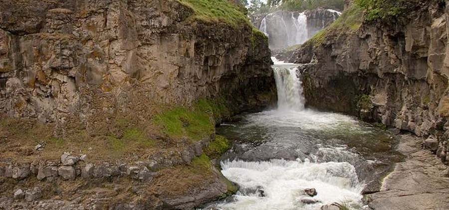
Sherars Falls is the final waterfall along the Deschutes River. The falls drop about 15 feet into a narrow horseshoe shaped trough carved in the vast flood basalt formations blanketing eastern Oregon. The Deschutes has been heavily tapped for irrigation purposes and because of this Sherars Falls is not usually as burly as it could be with the river flowing naturally, but its still a fairly impressive cascade. The geology of the area is generally more interesting than the waterfall, river volume aside, and one can expect to see dozens of members of the Warm Springs Nation fishing at the falls - a long established tribal fishing ground.

Sherar’s Falls, located within the ceded lands on the Deschutes River, is a traditional fishing site used by the Confederated Tribes of Warm Springs since time immemorial. Purchased by the Confederated Tribes of Warm Springs in the 1970s, the falls and lands adjacent to them have been put into trust. Currently, the Bureau of Land Management maintains the lands for the Tribe, however, tribal members continue to build their scaffols and fish for salmon at the falls. The Confederated Tribes of Warm Springs charges a use fee for non-tribal members to park at Sherar’s Fall.
Be the first to add a review to the Sherars Falls.
/-121.03855,45.25859,14/300x172@2x?access_token=pk.eyJ1Ijoicm9hZHRyaXBwZXJzIiwiYSI6ImNsdjQ5N2VtZDA2bW8ycW13ZHAxeGhjbjkifQ.UIccpoAxc7g3BAuK4s9vjg)
Sherars Falls
Hours
Problem with this listing? Let us know.
Has RV parking changed? Let us know.
-
Parking
-
Pets Allowed
-
Restrooms
-
Wifi
-
Wheelchair Accessible
-
Credit Cards Accepted
Nearby Hotels
Related Trip Guides
- Trip Guide
A road trip to filming locations featured in 'The Goonies'
- 6 Places
- 00:57
- 28 mi
- Trip Guide
The Ultimate Guide to Crater Lake National Park
- 15 Places
- Trip Guide
- Weekend
Pacific Coast Highway: Oregon - Washington
- 30 Places
- 17:36
- 670 mi
- Trip Guide
The top things to do on a U.S. Route 20 road trip
- 23 Places
- 60:25
- 3,576 mi