“Experience the beauty of Washington”
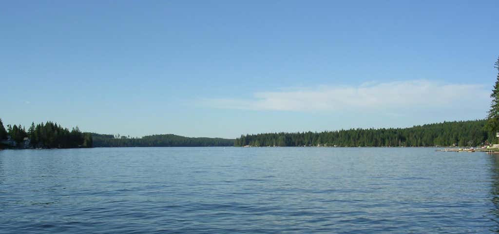
Mason Lake is a natural elongated lake south of Belfair, Washington, USA in Mason County. Named for Charles H. Mason, the first secretary of Washington Territory, the lake is on the isthmus of the Kitsap Peninsula between the Hood Canal and Pickering Passage of the Case Inlet. The smaller Benson Lake is to its eastern side. Mason Lake is approximately 1000 acres in size and four miles long. Its maximum depth is 90 feet and the mean depth is 48 feet. With 10.9 miles of shoreline, the lake sits at 194 feet above sea level. More than a thousand residents live yearlong around the shores of Mason Lake, the second largest freshwater lake in Mason County, second to the manmade Lake Cushman to its northwest. Originally a summer vacation community, the lake has always been known for its power boats, jet skis and water skiing. A county park provides swimming, picnic and boat launching access. The single lane boat launch is on the steeper side and winches tend to get jammed if they're in the locked or retrieval state.

DISCOVERY PASS IS NOT WORKING. A valid "Recreation Pass" is required at Ira Spring Trailhead.
Sun-drenched ridgelines, blooming trillium, and sparkling alpine waters define this fitting tribute to one of Washington’s greatest trail advocates. An ode to lifelong nature photographer and conservationist Ira Spring, this highly popular summer trail traverses steep pitches and open meadows en route to Mason Lake, a popular weekend camping destination in its own right.
From the parking lot, the trail meanders through dense forest and gently climbs a few long switchbacks until reaching Mason Creek at 0.8 mile. Normally docile from late spring to fall, be aware that raging currents in high water make this crossing treacherous at times, particularly for children and pets.
At 1.6 miles, veer left at an obvious but unmarked junction and take a deep breath -- the real climbing starts here. Ascending several steep pitches, the trail zigzags above tree line into an alpine meadow bursting with seasonal wildflowers and mountain vistas. Stay left at the junction with the Bandera Mountain Trail at 2.9 miles and continue climbing north toward the high point of the hike, a rocky crest at 4,320 feet. Here, expansive views to the south and west reveal prime photo opportunities and glimpses of Mount Rainier on clear days.
Drop over the north side of the ridge into the Alpine Lakes Wilderness, quickly descending about 300 feet to the shores of Mason Lake -- a small but deep alpine pool swimming with plump trout.
The main trail continues along the west and north banks of the lake to several designated camping areas, complete with a backcountry privy. Find an unclaimed boulder on the shore and soak in sunlight while enjoying views of Bandera Mountain and its tree-lined slopes reflect off the cool waters.
WTA Pro Tip: There are several ways you can lengthen your trip here.
Option 1: From the junction with the Bandera Mountain Trail, head to the summit of Little Bandera Mountain -- a short but aggressive 0.6-mile jaunt to elevated lake views and sweeping northwest vistas. But don’t underestimate the effort required; from the turnoff, this narrow path soars 700 feet up the ridge spine in just over half of a mile.
Option 2: From Mason Lake, follow the main trail along the north bank to the junction with Mount Defiance Trail. Turn left and follow this trail for 1.3 miles until reaching a spur trail to the summit at 5,200 feet. Views abound at the crest, but the 5,584-foot summit is a steep climb and scramble along the rough 0.2-mile spur trail.
Great hike. Starts at IRA SPRING TRAIL (leads to Mason Lake 3.4 miles & Bandera Mountain 3.8 miles). To find the start of the trail, check out 47°25'32.5"N 121°35'03.5"W in Google Maps https://goo.gl/maps/Wq398
The lake is great. Water is goo enough for swimming in the right weather. The hike can be hard but if you want extreme, you can go back to parking lot by climbing waterfall. That's what we did. After a while, you will be able to see secret trail that will lead you all the way down.
Be the first to add a review to the Mason Lake.
/-121.551306,47.423771,14/300x172@2x?access_token=pk.eyJ1Ijoicm9hZHRyaXBwZXJzIiwiYSI6ImNsdjQ5N2VtZDA2bW8ycW13ZHAxeGhjbjkifQ.UIccpoAxc7g3BAuK4s9vjg)
Mason Lake
Hours
Problem with this listing? Let us know.
Has RV parking changed? Let us know.
-
Parking
-
Pets Allowed
-
Restrooms
-
Wifi
-
Wheelchair Accessible
-
Credit Cards Accepted
Nearby Hotels
Related Trip Guides
- Trip Guide
The Great Northern is a 3,600 mile, cross-country odyssey
- 57 Places
- 69:15
- 3,565 mi
- Trip Guide
- Weekend
Pacific Coast Highway: Oregon - Washington
- 30 Places
- 17:36
- 670 mi
- Trip Guide
The ultimate guide to North Cascades National Park
- 13 Places
- Trip Guide
Olympic National Park is 1,400 sq miles of primeval beauty
- 14 Places