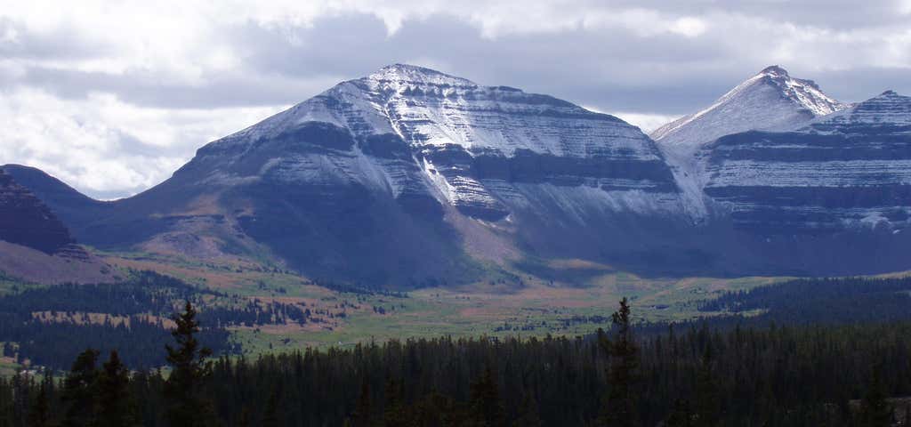
Kings Peak is the highest peak in the U.S. state of Utah, with an elevation of . It lies just south of the spine of the central Uinta Mountains, in the Ashley National Forest in northeastern Utah, in north-central Duchesne County. It lies within the boundaries of the High Uintas Wilderness. The peak is approximately due east of central Salt Lake City, and due north of the town of Duchesne. There are three popular routes to the summit; a scramble up the east slope, a hike up the northern ridge, and a long but relatively easy hike up the southern slope. The peak was named for Clarence King, a surveyor in the area and the first director of the United States Geological Survey. Kings Peak is generally regarded as the hardest state highpoint which can be climbed without specialist rock climbing skills and/or guiding. The easiest route requires a 29 mile round trip hike. Henry's Fork Basin to the north is criss-crossed with hiking trails. Kings Peak is the peak in the distance, with Anderson pass to the right and West Gunsight behind the sign
Be the first to add a review to the Kings Peak.
/-110.37279998463598,40.77639999528481,14/300x172@2x?access_token=pk.eyJ1Ijoicm9hZHRyaXBwZXJzIiwiYSI6ImNsdjQ5N2VtZDA2bW8ycW13ZHAxeGhjbjkifQ.UIccpoAxc7g3BAuK4s9vjg)
Kings Peak
Hours
Problem with this listing? Let us know.
Has RV parking changed? Let us know.
-
Parking
-
Pets Allowed
-
Restrooms
-
Wifi
-
Wheelchair Accessible
-
Credit Cards Accepted
Related Trip Guides
- Trip Guide
Pay Tribute and Reflect at These US Monuments and Memorials
- 14 Places
- Trip Guide
The ultimate road trip guide to Canyonlands National Park
- 18 Places
- Trip Guide
How to best experience Zion National Park
- 15 Places
- Trip Guide
Road trip to the filming locations of 'Dumb and Dumber'
- 8 Places
- 41:01
- 2,643 mi