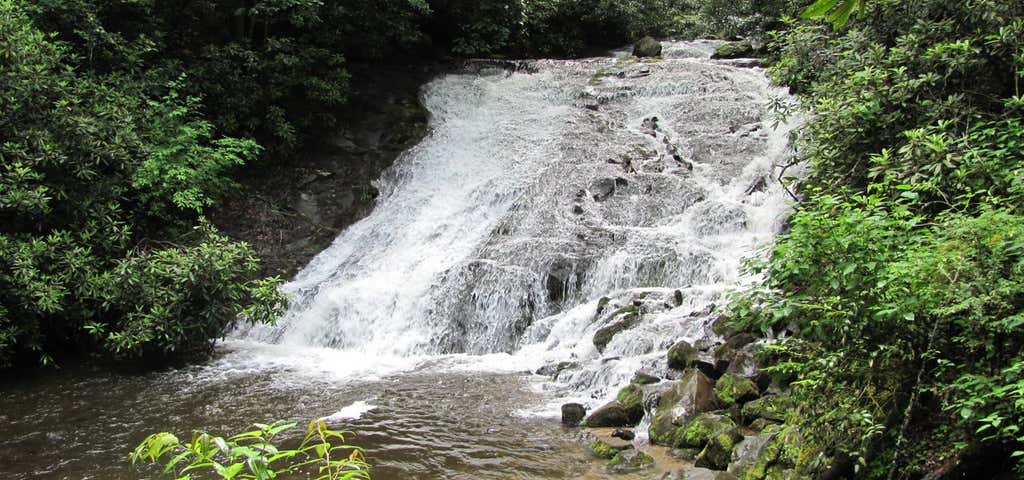
“This is a bit steep...”
This trail, in the Strawberry Wilderness area, is very steep. Directions from Prairie City: take Forest Service road 14 south to Summit Prairie. Turn west on Forest Service road 16 and proceed past Logan Valley to Forest Service Road 1640. Turn north on Forest Road 1640 and proceed to Road's End Trailhead #201A and Pine Creek Trail #201.
Read More >
Thanks!
Your Rating
1
2
3
4
5

June 17, 2015
This trail, in the Strawberry Wilderness area, is very steep.
Was this helpful?
Be the first to add a review to the Indian Creek Trail (short).
/-118.6841929,44.2247698,14/300x172@2x?access_token=pk.eyJ1Ijoicm9hZHRyaXBwZXJzIiwiYSI6ImNsdjQ5N2VtZDA2bW8ycW13ZHAxeGhjbjkifQ.UIccpoAxc7g3BAuK4s9vjg)
Indian Creek Trail (short)
National Forest Development Road 1640, Malheur National Forest
Oregon
97869
USA
Hours
Hours not available
Problem with this listing? Let us know.
Has RV parking changed? Let us know.
-
Parking
-
Pets Allowed
-
Restrooms
-
Wifi
-
Wheelchair Accessible
-
Credit Cards Accepted
Nearby Hotels
John Day,
Oregon
John Day,
Oregon
Prairie City,
Oregon
John Day,
Oregon
John Day,
Oregon
Related Trip Guides
- Trip Guide
A road trip to filming locations featured in 'The Goonies'
- 6 Places
- 00:57
- 28 mi
- Trip Guide
The Ultimate Guide to Crater Lake National Park
- 15 Places
- Trip Guide
- Weekend
Pacific Coast Highway: Oregon - Washington
- 30 Places
- 17:36
- 670 mi
- Trip Guide
The top things to do on a U.S. Route 20 road trip
- 23 Places
- 60:25
- 3,576 mi
45679