“offers views of high mountain meadows”
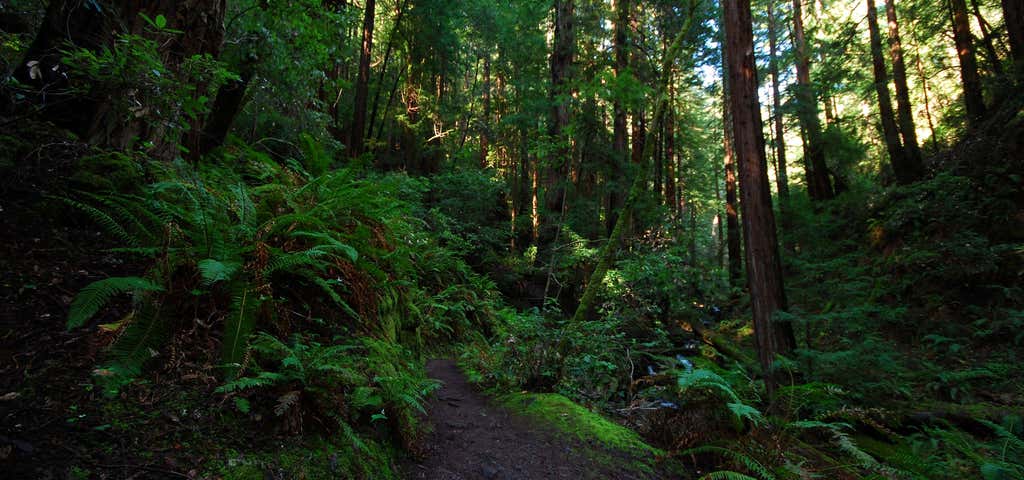
Beginning at the confluence of Muir Creek and the Rogue River, the Muir Creek Trail traverses the west bank of Muir Creek for 3.9 miles. Passing through a forest of Douglas-fir, western white pine, and western hemlock, the trail offers views of high mountain meadows and thickets of box alder along the meandering creek. The early morning hiker may spot elk and deer grazing in the river meadows. Tiger lilies, columbine, and scarlet gilia are common floral vegetation in the moist, open meadows and along the stream banks. Besides viewing the abundant wildlife in the area, this trail provides opportunities for picnicking and fishing for cutthroat trout. Huckleberries, blackberries, and strawberries are found towards the north end of the trail. Listen for Muir Creek Falls located approximately three miles north of the trailhead. Water is plentiful along the trail; however, we recommend that you carry your own water. Cattle frequent the area, and water sources could be contaminated. The Muir Creek Trail ends at the Buck Canyon cutoff trail, " mile from road #6560. Directions from Prospect: Follow Highway #62 north to the junction of Highway #230. Continue north on Highway #230 north for approximately 10.4 miles, turning into the parking area on the left, just before crossing the Muir Creek bridge.

Beginning at the confluence of Muir Creek and the Rogue River, the Muir Creek Trail traverses the west bank of Muir Creek for 3.9 miles. Passing through a forest of Douglas-fir, western white pine, and western hemlock, the trail offers views of high mountain meadows and thickets of box alder along the meandering creek. The early morning hiker may spot elk and deer grazing in the river meadows. Tiger lilies, columbine, and scarlet gilia are common floral vegetation in the moist, open meadows and along the stream banks. Besides viewing the abundant wildlife in the area, this trail provides opportunities for picnicking and fishing for cutthroat trout. Huckleberries, blackberries, and strawberries are found towards the north end of the trail. Listen for Muir Creek Falls located approximately three miles north of the trailhead. Water is plentiful along the trail; however, we recommend that you carry your own water. Cattle frequent the area, and water sources could be contaminated. The Muir Creek Trail ends at the Buck Canyon cutoff trail, " mile from road #6560.
Be the first to add a review to the Muir Creek Trail.
/-122.3576519,43.0371699,14/300x172@2x?access_token=pk.eyJ1Ijoicm9hZHRyaXBwZXJzIiwiYSI6ImNsdjQ5N2VtZDA2bW8ycW13ZHAxeGhjbjkifQ.UIccpoAxc7g3BAuK4s9vjg)
Muir Creek Trail
Hours
Problem with this listing? Let us know.
Has RV parking changed? Let us know.
-
Parking
-
Pets Allowed
-
Restrooms
-
Wifi
-
Wheelchair Accessible
-
Credit Cards Accepted
Nearby Hotels
Click to find bookable tours and activities here
Related Trip Guides
- Trip Guide
A road trip to filming locations featured in 'The Goonies'
- 6 Places
- 00:57
- 28 mi
- Trip Guide
The Ultimate Guide to Crater Lake National Park
- 15 Places
- Trip Guide
- Weekend
Pacific Coast Highway: Oregon - Washington
- 30 Places
- 17:36
- 670 mi
- Trip Guide
The top things to do on a U.S. Route 20 road trip
- 23 Places
- 60:25
- 3,576 mi