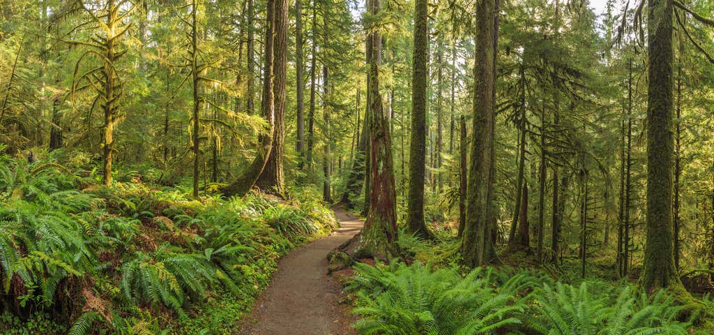
“hike through a temperate rainforest”
Ecosystem type: Temperate rainforest, subalpine meadow, subalpine meadow basin, montane forest Trail tread types: Well-maintained General elevation trend: Flat to steep - The trail is generally flat for the first 13 miles then becomes steep to Glacier Meadows. River crossings: There is one crossing of a braid of the river near 8-mile and a few small stream crossings. Unique features: Temperate rain forest, opportunites to view wildlife, views of Mt. Olympus and Blue Glacier from the end of the trail. Level of difficulty: Easy to Moderate Distance: 17.4 miles to Glacier Meadows Elevation change: 600 ft. to 4,300 ft. Best Season: Late June through September In early season several steep snow slopes exist along this trail. An ice axe may be required for much of the spring and early summer. It may also be difficult to follow sections of trail due to snow. Map and compass skills may also be required during much of the spring and summer. During Winter months, travel above Elk Lake is not recommended due to steep avalanche chutes. Ropes and anchors may be necessary to cross these safety. General Location: 20 miles southwest of Forks, WA.
Reviews

I highly suggest this trail. Less crowded and a bit more intense than Hall of Mosses... and if you don't want to go all the way to Glacier Meadows, you can just hike out as far as you want and then turn around and go back the way you came.

Beautiful beautiful beautiful. A must see.

Wish me had more time! Great trail and beautiful area
Be the first to add a review to the Hoh River Trail.
/-123.9337,47.8597,14/300x172@2x?access_token=pk.eyJ1Ijoicm9hZHRyaXBwZXJzIiwiYSI6ImNsdjQ5N2VtZDA2bW8ycW13ZHAxeGhjbjkifQ.UIccpoAxc7g3BAuK4s9vjg)
Hoh River Trail
Hours
- Sun - Sat: 12:00 am - 11:59 pm
Problem with this listing? Let us know.
Has RV parking changed? Let us know.
-
Parking
-
Pets Allowed
-
Restrooms
-
Wifi
-
Wheelchair Accessible
-
Credit Cards Accepted
-
Outdoor Seating
Parking, Dining
Nearby Hotels
Related Trip Guides
- Trip Guide
The Great Northern is a 3,600 mile, cross-country odyssey
- 57 Places
- 69:15
- 3,565 mi
- Trip Guide
- Weekend
Pacific Coast Highway: Oregon - Washington
- 30 Places
- 17:36
- 670 mi
- Trip Guide
The ultimate guide to North Cascades National Park
- 13 Places
- Trip Guide
Olympic National Park is 1,400 sq miles of primeval beauty
- 14 Places