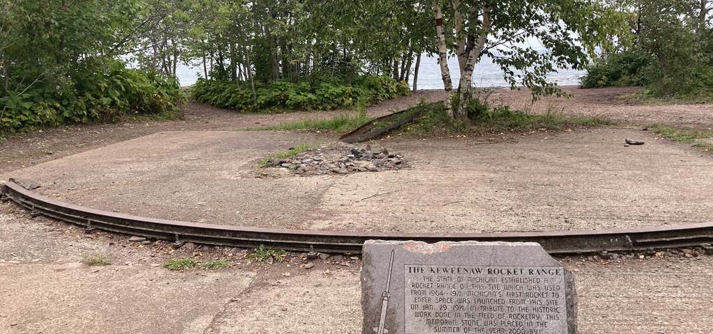
Map showing the location of the Range at the tip of the peninsula. The Keweenaw Rocket Range was an isolated launch pad located in U.S. state of Michigan’s Keweenaw Peninsula. It was used between 1964 and 1971 for launching rockets for meteorological data collection. NASA, along with the University of Michigan, conducted the project under the lead of Dr. Harold Allen. The site was one of six similar sites scattered about North America used to collect measurements of electron density, positive ion composition and distribution, energetic electron precipitation, solar X-rays, and Lyman alpha flux. One of the other well-known sites was Wallops Island, Virginia. The collected data was later to be compared to the five other sites.
Be the first to add a review to the Keweenaw Rocket Range.
/-87.71485998778999,47.430249994913794,14/300x172@2x?access_token=pk.eyJ1Ijoicm9hZHRyaXBwZXJzIiwiYSI6ImNsdjQ5N2VtZDA2bW8ycW13ZHAxeGhjbjkifQ.UIccpoAxc7g3BAuK4s9vjg)
Keweenaw Rocket Range
Hours
Problem with this listing? Let us know.
Has RV parking changed? Let us know.
-
Parking
-
Pets Allowed
-
Restrooms
-
Wifi
-
Wheelchair Accessible
-
Credit Cards Accepted
Nearby Hotels
Related Trip Guides
- Trip Guide
The Great Northern is a 3,600 mile, cross-country odyssey
- 57 Places
- 69:15
- 3,565 mi
- Trip Guide
Gone But Not Forgotten: Former National Parks
- 7 Places
- Trip Guide
The top things to do on a Tunnel of Trees road trip
- 12 Places
- 00:51
- 31 mi
- Trip Guide
The top things to do on an I-75 road trip
- 34 Places
- 31:05
- 1,933 mi