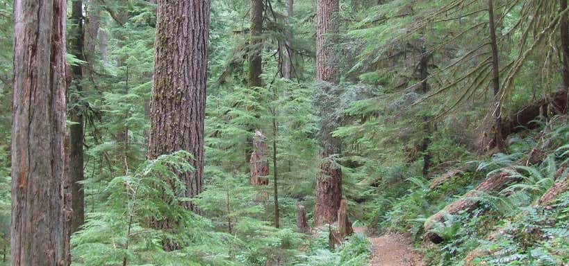
“full of mature old-growth trees”
The United States Congress designated the Middle Santiam Wilderness (map) in 1984 and it now has a total of 8,900 acres. All of this wilderness is located in Oregon and is managed by the Forest Service. Mature old-growth trees shadow virtually all of this Wilderness, with Douglas fir, western red cedar, and western hemlock at lower elevations and true firs higher up. Some of the trees, estimated to be 450 years old, tower to more than 200 feet. Gently sloping, benchy terrain in the lower country starts at about 1,600 feet and rises to steep slopes, ridges, and peaks that reach 5,022 feet above sea level. The most prominent geological feature is 4,965-foot Chimney Peak, a lava plug in the northwestern portion. The Middle Santiam River flows through the area, slowing into quiet pools with mossy banks. Both the river and Donaca Lake teem with native fish, including chinook salmon during spawning season. Not far to the south lies Menagerie Wilderness. Four seldom-hiked trails provide access routes to the area: McQuade Creek (5.2 miles); Chimney Peak (12.7 miles); and Gordan Peak (6.1 miles), and Swamp Peak (6.1 miles)
Reviews

Be the first to add a review to the Middle Santiam Wilderness.
/-122.1722144,44.4016958,14/300x172@2x?access_token=pk.eyJ1Ijoicm9hZHRyaXBwZXJzIiwiYSI6ImNsdjQ5N2VtZDA2bW8ycW13ZHAxeGhjbjkifQ.UIccpoAxc7g3BAuK4s9vjg)
Middle Santiam Wilderness
Hours
Problem with this listing? Let us know.
Has RV parking changed? Let us know.
-
Parking
-
Pets Allowed
-
Restrooms
-
Wifi
-
Wheelchair Accessible
-
Credit Cards Accepted
Nearby Hotels
Related Trip Guides
- Trip Guide
A road trip to filming locations featured in 'The Goonies'
- 6 Places
- 00:57
- 28 mi
- Trip Guide
The Ultimate Guide to Crater Lake National Park
- 15 Places
- Trip Guide
- Weekend
Pacific Coast Highway: Oregon - Washington
- 30 Places
- 17:36
- 670 mi
- Trip Guide
The top things to do on a U.S. Route 20 road trip
- 23 Places
- 60:25
- 3,576 mi