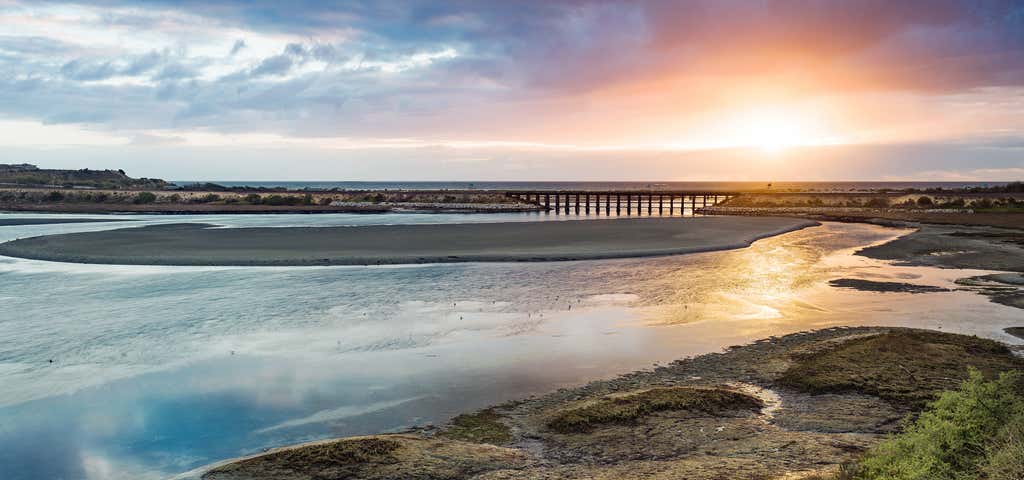
The lagoon can be seen and experienced from a nature trail on the north side. The public walking and hiking trail is about 2 miles long. It starts just east of Interstate 5 at the end of Gabbiano Lane and goes most of the way to El Camino Real on the east end of the lagoon. There are five public parking lots providing access to the trail, one by the Nature Center and four on Batiquitos Drive. Dogs on a leash are allowed. Horses and bicycles are not allowed. The lagoon itself consists of 610 acres with a drainage basin of about 55,000 acres. The watershed basin includes the cities of Carlsbad, San Marcos, and Encinitas, with its primary freshwater tributaries being San Marcos Creek from the east and Encinitas Creek which flows north along Green Valley, entering the lagoon under El Camino Real and La Costa Avenue, respectively. Accumulated silt has been filling up Batiquitos Lagoon, and the lagoon was expected to fill up within 50 years. Instead, a large dredging and enhancement project began in 1994 to open the lagoon to the ocean’s tidal changes and flows, thus slowing down the filling of the lagoon with silt. This project, completed in 1997, was funded by the Port of Los Angeles.
Be the first to add a review to the Batiquitos Lagoon Trail.
/-117.30258,33.095535,14/300x172@2x?access_token=pk.eyJ1Ijoicm9hZHRyaXBwZXJzIiwiYSI6ImNsdjQ5N2VtZDA2bW8ycW13ZHAxeGhjbjkifQ.UIccpoAxc7g3BAuK4s9vjg)
Batiquitos Lagoon Trail
Hours
Problem with this listing? Let us know.
Has RV parking changed? Let us know.
-
Parking
-
Pets Allowed
-
Restrooms
-
Wifi
-
Wheelchair Accessible
-
Credit Cards Accepted
Nearby Hotels
Related Trip Guides
- Trip Guide
Pay Tribute and Reflect at These US Monuments and Memorials
- 14 Places
- Trip Guide
The Ultimate Guide To Joshua Tree National Park
- 53 Places
- 11:44
- 408 mi
- Trip Guide
The top things to do on an I-40 road trip
- 35 Places
- 49:44
- 2,851 mi
- Trip Guide
The top things to do on an I-10 road trip
- 55 Places
- 56:13
- 3,026 mi