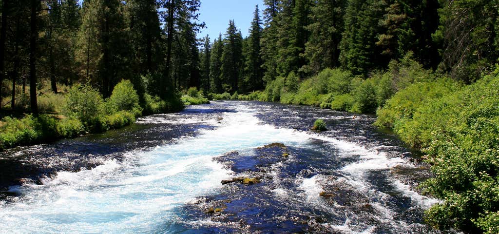
“a combination of riverside and forest settings”
Trail Description: Hiking trails run both north (downstream) or south along the Metolius from Wizard Falls Fish Hatchery. Any distance from 0 to 10 miles may be hiked by following the same trail out and back. A hike upstream along the west bank leads to the confluence of the Canyon Creek Campground is a spectacular sight. From the Hatchery a 6.5 mile loop can be accomplished by hiking downstream to Lower Bridge, crossing the river, and returning on the opposite bank. This loop offers a combination of riverside and forest settings. Osprey nests and a beaver dam may be seen along the way. The first users of forest trails along the river were Indians. It was they who gave the river its name - Metolius. Some say the name means "white fish", others say it means "stinking water" or "spawning salmon". In any case, the name of the river makes reference to its outstanding fishery. Salmon from the Pacific Ocean spawned in the Metolius and its tributaries before dams obstructed their path. The river is now host to rainbow, brook, brown and bull trout; whitefish and kokanee. Restroom facilities and water are available at Wizard Falls Fish Hatchery. The trail leaves the river near some private property downstream from the fish hatchery. Please respect the property owner's privacy and stay outside fence lines. Directions from Sisters: Proceed west from Sisters on Highway 20 for 10 miles and turn right at the sign for Camp Sherman (Road 14). Proceed on Rd. 14 for 7 miles past the "Head of the Metolius". Wizard Falls Fish Hatchery will be a left turn off of Road 14.

Trail Description: Hiking trails run both north (downstream) or south along the Metolius from Wizard Falls Fish Hatchery. Any distance from 0 to 10 miles may be hiked by following the same trail out and back. A hike upstream along the west bank leads to the confluence of the Canyon Creek Campground is a spectacular sight.
From the Hatchery a 6.5 mile loop can be accomplished by hiking downstream to Lower Bridge, crossing the river, and returning on the opposite bank. This loop offers a combination of riverside and forest settings. Osprey nests and a beaver dam may be seen along the way.
The first users of forest trails along the river were Indians. It was they who gave the river its name - Metolius. Some say the name means "white fish", others say it means "stinking water" or "spawning salmon". In any case, the name of the river makes reference to its outstanding fishery. Salmon from the Pacific Ocean spawned in the Metolius and its tributaries before dams obstructed their path. The river is now host to rainbow, brook, brown and bull trout; whitefish and kokanee.
Restroom facilities and water are available at Wizard Falls Fish Hatchery. The trail leaves the river near some private property downstream from the fish hatchery. Please respect the property owner's privacy and stay outside fence lines.
Be the first to add a review to the Metolius River Trail.
/-121.6312453,44.5212062,14/300x172@2x?access_token=pk.eyJ1Ijoicm9hZHRyaXBwZXJzIiwiYSI6ImNsdjQ5N2VtZDA2bW8ycW13ZHAxeGhjbjkifQ.UIccpoAxc7g3BAuK4s9vjg)
Metolius River Trail
Hours
Problem with this listing? Let us know.
Has RV parking changed? Let us know.
-
Parking
-
Pets Allowed
-
Restrooms
-
Wifi
-
Wheelchair Accessible
-
Credit Cards Accepted
Nearby Hotels
Related Trip Guides
- Trip Guide
A road trip to filming locations featured in 'The Goonies'
- 6 Places
- 00:57
- 28 mi
- Trip Guide
The Ultimate Guide to Crater Lake National Park
- 15 Places
- Trip Guide
- Weekend
Pacific Coast Highway: Oregon - Washington
- 30 Places
- 17:36
- 670 mi
- Trip Guide
The top things to do on a U.S. Route 20 road trip
- 23 Places
- 60:25
- 3,576 mi