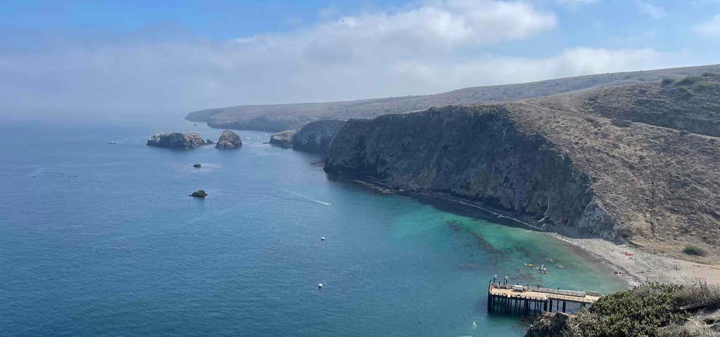
Map of Channel Islands The north coast of Santa Cruz Island in August. Santa Cruz Island is the largest of the eight islands in the Channel Islands of California, located off the coast of California. The island, in the northern group of the Channel Islands, is long and from wide with an area of . Santa Cruz Island is located within Santa Barbara County, California. The coastline has steep cliffs, gigantic sea caves, coves, and sandy beaches. Defined by the United States Census Bureau as Block 3000, Block Group 3, Census Tract 29.10 of Santa Barbara County, the 2000 census showed an official population of two persons. The highest peak is Devils Peak, at 2450+ feet (747+ m). It was the largest privately owned island off the continental United States but is currently jointly owned by the National Park Service (24%), and the Nature Conservancy (76%). A central valley splits the island along the Santa Cruz Island Fault, with volcanic rock on the north and older sedimentary rock on the south. This volcanic rock was heavily fractured during the uplift phase that formed the island and over a hundred large sea caves have been carved into the resulting faults. One of these, Painted Cave, is among the world's largest. Santa Cruz Island has many species found nowhere else on earth, including for instance the Santa Cruz Island Horse, the island scrub jay and the Santa Cruz Island fox (Urocyon littoralis santacruzae), a subspecies of the Island Fox.
Be the first to add a review to the Santa Cruz Island.
/-119.91527777777779,34.06055555555555,14/300x172@2x?access_token=pk.eyJ1Ijoicm9hZHRyaXBwZXJzIiwiYSI6ImNsdjQ5N2VtZDA2bW8ycW13ZHAxeGhjbjkifQ.UIccpoAxc7g3BAuK4s9vjg)
Santa Cruz Island
Hours
Problem with this listing? Let us know.
Has RV parking changed? Let us know.
-
Parking
-
Pets Allowed
-
Restrooms
-
Wifi
-
Wheelchair Accessible
-
Credit Cards Accepted
Nearby Hotels
Related Trip Guides
- Trip Guide
Pay Tribute and Reflect at These US Monuments and Memorials
- 14 Places
- Trip Guide
The Ultimate Guide To Joshua Tree National Park
- 53 Places
- 11:44
- 408 mi
- Trip Guide
The top things to do on an I-40 road trip
- 35 Places
- 49:44
- 2,851 mi
- Trip Guide
The top things to do on an I-10 road trip
- 55 Places
- 56:13
- 3,026 mi