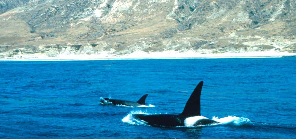
Map of Channel Islands sanctuary The Channel Islands National Marine Sanctuary is a sanctuary off the Pacific coast of Southern California. The National Marine Sanctuary program is administered by the National Oceanic and Atmospheric Administration. Established May 5, 1980, the sanctuary in the Santa Barbara Channel is an area of national significance because of its natural environment and resources. It also had removed sheep from the islands to conserve vegetation among the islands to keep its natural environment, grass and plants. It has an area of and encompasses the waters that surround Anacapa, Santa Cruz, Santa Rosa, San Miguel and Santa Barbara Islands (five of the eight Channel Islands of California), extending from mean high tide to offshore around each of the five islands. The sanctuary is home to an extremely rich and diverse array of marine species, making it one of the best places in the world for viewing whales and other wildlife. It also provides protection to more than 150 historic shipwrecks and is a place of important cultural significance for the Chumash people. Channel Islands National Marine Sanctuary provides protection for its natural and cultural resources through education, conservation, science, and stewardship.
Be the first to add a review to the Channel Islands National Marine Sanctuary.
/-120.0,34.0,14/300x172@2x?access_token=pk.eyJ1Ijoicm9hZHRyaXBwZXJzIiwiYSI6ImNsdjQ5N2VtZDA2bW8ycW13ZHAxeGhjbjkifQ.UIccpoAxc7g3BAuK4s9vjg)
Channel Islands National Marine Sanctuary
Hours
Problem with this listing? Let us know.
Has RV parking changed? Let us know.
-
Parking
-
Pets Allowed
-
Restrooms
-
Wifi
-
Wheelchair Accessible
-
Credit Cards Accepted
Related Trip Guides
- Trip Guide
Pay Tribute and Reflect at These US Monuments and Memorials
- 14 Places
- Trip Guide
The Ultimate Guide To Joshua Tree National Park
- 53 Places
- 11:44
- 408 mi
- Trip Guide
The top things to do on an I-40 road trip
- 35 Places
- 49:44
- 2,851 mi
- Trip Guide
The top things to do on an I-10 road trip
- 55 Places
- 56:13
- 3,026 mi