“looping trail for foot and bike traffic”
Head west on the Brooks-Scanlon road and turn left on an abandoned road 1/4 mile from the trailhead. Follow this road 1/4 mile to the junction of another road and bear left. Continue winding along this road till you come to a cinder pit and turn right onto FS 020. Bear left at the first fork and ride to the junction with a cinder road. Turn right onto this road (FS 030) and continue along this road to a pit. Watch for the road to continue to the left of the pit. Half a mile past the pit you will come to the junction of another road where you will head straight. This road will turn into a trail and climb up through a canyon. At the top you will cross FS 4610. Bear left at the first fork in the trail and continue along this trail for approximately 2.5 miles. Finally, leave the trail and take a right down the 3rd road and follow this for a short distance and take a right onto FS 4610, head left and follow this for 0.25 mile o a road on the right just before you get to Skyliner's road. Follow this road, as it enters the Big Burn, head left at the first fork. Skirt the forest's edge and take the first left through the burn onto an old abandoned road. Remain on this road by bearing to the left at the next four junctions to arrive back at the Brooks-Scanlon Road where you will turn right to get back to the trailhead. A lot of the roads are unmarked so watch for the Bike Route signposts.

Directions are not really necessary. Go to the Phils Trailhead and look for the very well marked trail signs and maps. NOTE: as of April 2014, Phils trail is downhill only. There are multiple other ways up, Kent's or Ben's are most popular. Good beginner/intermediate trail.

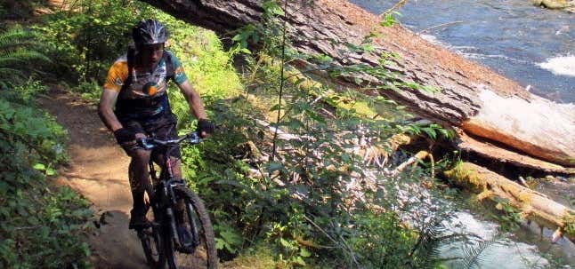
Phil’s Trail is both the name of a very popular mountain bike trail near Bend, but also the general name the locals have given for the huge complex of singletrack trails in the area.
Located just a couple miles from the center of town, the singletrack starts before you even reach the parking area with a ribbon of dirt paralleling Skyliners Road beginning at the Mt. Washington Road roundabout. There’s a couple of places to park along Skyliners where you maximize your dirt experience.
Once at the parking area, just a half mile down the paved Forest Road 4606, you’ll find trailheads for Ben’s, Kent’s, Phil’s and Marvin’s Garden. (There’s a vault toilet there as well.)
Pick any one of the routes and you’re set. A little farther up you’ll run into KGB, MTB, Grand Slam, VooDoo, ELV and more trails that are very well marked.
You can do a short out and back, combine some trails to make a longer loop or make it a full day in the saddle by pedaling nearly all the way up to the base of the Cascades before screaming with delight on your way back down.
You can also pedal up toward the Cascades and cross Cascade Lakes Highway to a newer network of trails that are quite popular including Tiddlywinks, Funner and the Steve Larsen trails.
Be the first to add a review to the Phil's Trail Loop.
/-121.4636315,44.1538097,14/300x172@2x?access_token=pk.eyJ1Ijoicm9hZHRyaXBwZXJzIiwiYSI6ImNsdjQ5N2VtZDA2bW8ycW13ZHAxeGhjbjkifQ.UIccpoAxc7g3BAuK4s9vjg)
Phil's Trail Loop
Hours
Problem with this listing? Let us know.
Has RV parking changed? Let us know.
-
Parking
-
Pets Allowed
-
Restrooms
-
Wifi
-
Wheelchair Accessible
-
Credit Cards Accepted
Nearby Hotels
Related Trip Guides
- Trip Guide
A road trip to filming locations featured in 'The Goonies'
- 6 Places
- 00:57
- 28 mi
- Trip Guide
The Ultimate Guide to Crater Lake National Park
- 15 Places
- Trip Guide
- Weekend
Pacific Coast Highway: Oregon - Washington
- 30 Places
- 17:36
- 670 mi
- Trip Guide
The top things to do on a U.S. Route 20 road trip
- 23 Places
- 60:25
- 3,576 mi