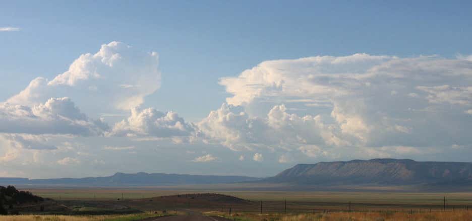
Aubrey Valley is a 35-mile (56 km) long valley located in southwest Coconino County, Arizona with the northwest border of Yavapai County. The valley is located at the southwest border of the Aubrey Cliffs; to the west and southwest, the Yampai Divide and the Seventyfour Plains form flatlands between four bordering mountain ranges at the northwest terminus of the Arizona transition zone. The Aubrey Cliffs form the east and northeast valley border, and are part of the escarpment at the southwest perimeter of the Coconino Plateau, southwest Colorado Plateau. The Aubrey Cliffs re-appear northwest of the valley's north end, at the southeast of Prospect Valley. The Toroweap Fault is buried near the center of Aubrey Valley, west of the cliffs, and continues northwest into Prospect Valley, and to the Colorado River, west Grand Canyon. The Hurricane Fault-(of the Hurricane Cliffs) begins there, and both faults continue, the Hurricane going northwest, the Toroweap northeast, into southern Utah. The south Aubrey Valley is the route of historic U.S. Route 66, now superseded by Interstate 40. The Aubrey Valley supports a population of endangered black-footed ferrets, reintroduced in 1996 due to Valley's prairie dog colonies and favorable grassland habitat.
Be the first to add a review to the Aubrey Valley.
/-113.13722222222223,35.45722222222223,14/300x172@2x?access_token=pk.eyJ1Ijoicm9hZHRyaXBwZXJzIiwiYSI6ImNsdjQ5N2VtZDA2bW8ycW13ZHAxeGhjbjkifQ.UIccpoAxc7g3BAuK4s9vjg)
Aubrey Valley
Hours
Problem with this listing? Let us know.
Has RV parking changed? Let us know.
-
Parking
-
Pets Allowed
-
Restrooms
-
Wifi
-
Wheelchair Accessible
-
Credit Cards Accepted
Nearby Hotels
Related Trip Guides
- Trip Guide
The top things to do on an I-40 road trip
- 35 Places
- 49:44
- 2,851 mi
- Trip Guide
The top things to do on an I-10 road trip
- 55 Places
- 56:13
- 3,026 mi
- Trip Guide
The ultimate guide to Petrified Forest National Park
- 15 Places
- Trip Guide
The ultimate guide to Grand Canyon National Park
- 14 Places