Remove Ads

A Highway 1 road trip along California’s Central Coast

It’s worth spending a few days exploring the 100-mile stretch of Pacific Coast Highway just south of Big Sur

  • 26
  • 40:19
  • 1,875 mi
  • $313
Take This Trip

Created by kimswaim - December 27th 2021

The California section of Highway 1 is perhaps most famous for the rugged cliffs, bridges, and waterfalls of Big Sur. But don’t sleep on the 100-mile section just south of Big Sur, known as the Highway 1 Discovery Route. Stretching from Nipomo in the south to Ragged Point in the north, this area is jam-packed with quaint beach towns, interesting wildlife, roadside attractions, outdoor recreation opportunities, amazing culinary experiences, and spectacular natural beauty.

Here’s what not to miss on a Pacific Coast Highway road trip along California’s Central Coast.

Photo of Scripps Pier
4.0

9500 Gilman Dr, San Diego, CA, US

Scripps Pier

1
118mi 02h 35m
Photo of Griffith Observatory
4.5

2800 East Observatory Road, Los Angeles, CA, US

Griffith Observatory

1
2
196mi 03h 46m
Photo of Montaña de Oro State Park
5.0

Pecho Road, Los Osos, CA, US

Montaña de Oro State Park

2

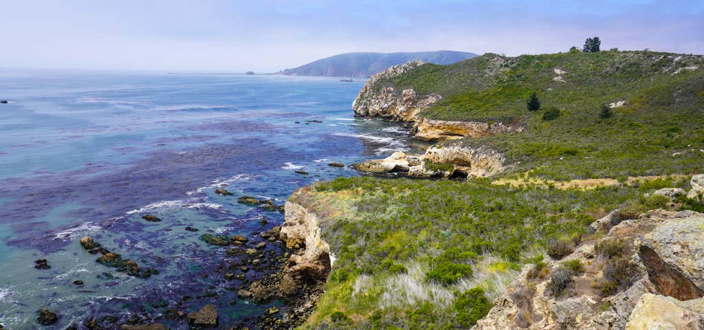
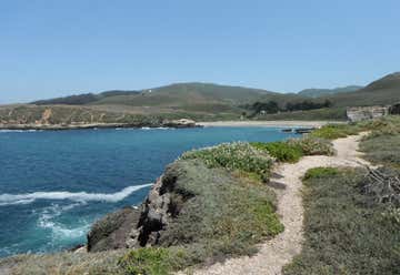
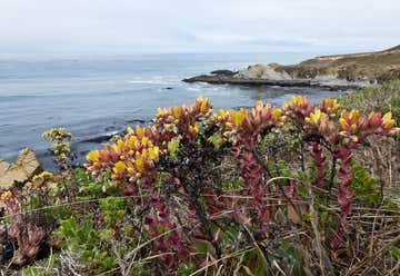
The name of this state park translates to “Mountain of Gold,” which feels accurate since it’s a real gem. The park is popular for its many hiking, mountain biking, and equestrian trails. Located right on the coast southwest of Baywood-Los Osos, it also features dramatic cliffs, secluded beaches, wildlife, and a dense eucalyptus forest with an enchanted vibe.

3
1mi 00h 04m
3
4
1mi 00h 04m
Photo of Point Buchon Trail
5.0

Pecho Valley Road, Los Osos, CA, US

Point Buchon Trail

4
5
13mi 00h 32m
Photo of Morro Rock State Preserve
4.0

Morro Bay State Park Rd, Morro Bay, CA, US

Morro Rock State Preserve

5

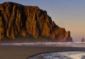
Morro Rock is impossible to miss when traveling along the coast through San Luis Obispo County. The 580-foot-tall volcanic plug sits on a tied island just outside of Morro Bay’s harbor. The area surrounding the rock is a state park open to visitors—including RVs up to 35 feet—or you can grab a bite on one of the harbor restaurant patios facing the coast and admire the rock from a distance.

6
11mi 00h 18m
Photo of Estero Bluffs State Park
4.0

750 Hearst Castle Road, San Simeon, CA, US

Estero Bluffs State Park

6
7
2mi 00h 03m
Photo of Harmony Headlands State Park
4.5

Highway 1, near Harmony (North of Cayucos), Cayucos, CA, US

Harmony Headlands State Park

7
8
21mi 00h 37m
Photo of Hearst Castle
4.5

750 Hearst Castle Rd, San Simeon, CA, US

Hearst Castle

8
9
9mi 00h 23m

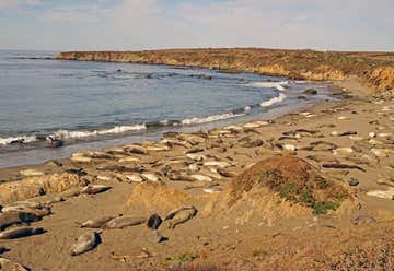
Five miles north of Hearst Castle, you’ll find another famous Central Coast attraction: the Piedras Blancas Elephant Seal Rookery. Walk out to the accessible viewing area and spend some time observing and photographing the colonies of northern elephant seals that sleep, flop, sunbathe, and swim along the shore. The second largest seal in the world, these slow-moving beasts can weigh up to 5,000 pounds. It’s an enjoyable—albeit smelly—quick stop on your trip north.

10
72mi 01h 48m

Highway 1, Big Sur, CA, US

Pfeiffer Big Sur State Park

10
11
18mi 00h 30m
Photo of 17 Mile Drive at Pebble Beach
4.1

1700 17-Mile Drive, Pebble Beach, CA, US

17 Mile Drive at Pebble Beach

11
13
4mi 00h 12m

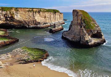
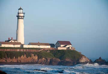
Monterey, CA, United States

13
14
242mi 04h 26m
Photo of Sequoia National Park
4.5

47050 Generals Highway, Three Rivers , CA, Three Rivers, CA, US

Sequoia National Park

14
15
247mi 04h 40m
Photo of Natural Bridges State Park
5.0

2531 West Cliff Dr, Santa Cruz, CA, US

Natural Bridges State Park

15
16
9mi 00h 17m
Photo of Shark Fin Cove Beach
4.0

Cabrillo Hwy, Davenport, CA, US

Shark Fin Cove Beach

16
17
17mi 00h 20m
18
52mi 01h 27m
Photo of Golden Gate Bridge
4.5

US Highway 101, San Francisco, CA, US

Golden Gate Bridge

18
19
33mi 00h 59m

1 Bear Valley Visitor Center Access Road,, Point Reyes Station, CA, US

Point Reyes National Seashore

19