***Tokopah Falls
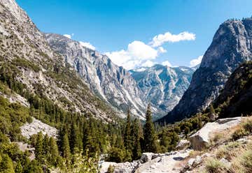
The trailhead for this hike is located within the Lodgepole campground at 7000ft. It is a fairly level hiking trail for novice hikers, families with kids and anyone looking for beautiful granite canyon walls. Round trip is well under 3 miles. The falls are best viewed in the Spring and early summer for maximum water fall activity but water does fall through most of the year.
It’s a longer hike, but so worth it! The falls are a dramatic 1200 foot cascade over dark gray boulders...it looks like something out of Lord of the Rings! So pack a little lunch and make an afternoon of it!
It’s a breathtaking hike that follows along the Middle Fork of the Kaweah River. Along the way you pass by lush, peaceful meadows, carpets of tiny, vivid pink flowers, and even some alien-looking flowers and fauna such as the Snowflower Plant that’ll have you debating whether it’s a flower or a mushroom! You’ll also pass by huge fallen trees and hop on rocks to cross shallow little bits of creeks...all while gazing up at Watchtower peak looming 1600 feet above!
Drive past the Lodgepole visitor center into Lodgepole campgrounds and park in the campground’s huge, paved parking lot. The entrance to the hike isn’t terribly obvious tYou walk through the campground gate and can see a bridge crossing the river. The entrance to the trail is just across the bridge to the right and has ample signage.
The hike itself is 1.7 miles from the entrance to the falls (so 3.4 miles total) and I’d call it a moderate hike. It took us just over 2 hours to complete it round trip. And that includes stopping for a quick little picnic lunch at the falls. Also, there are no confusing forks or turns...pretty much a straight shot to the falls. To get back out, you simply go back the way you came.
Overall it gains just over 600ft in elevation. It’s relatively flat for the first part with most of the elevation gain in the last 1/2 mile, where the trail becomes very rocky and narrow...but don’t let that scare you off!
*** Grant Grove, drive up to Panoramic Point, which is up behind the visitor center, for a great view of the High Sierra. If you have time, you can also stop at the Big Stump area and follow the short trail to the stumps of the trees that were cut during the logging era. The kids should get a kick out of that. When you climb atop one, you really get an idea of how huge these are.
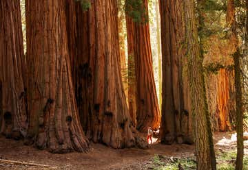
***General Sherman and Congress Trail - this is a 3 mile loop and is incredibly fun walking along and through the massive trees that make up the Senate and House groups and ending with the largest tree on planet earth.
**Moro Rock - ended the day with incredible 360 degree views by taking the short trail up the rock spine of moro rock! Looks scary but it’s not sketchy at all, super fun.A challenging walk up 400 steps to a spectacular view. Suggested duration 1-2 hours
Zumwalt Meadow Stunning drive down King’s Canyon scenic byway that was punctuated by our favorite hike at Zumwalt Meadow. Zumwalt was magical due to the combination of an area of the river at the start of the trail that was protected and Allowed you to have a small swim, followed by a short lovely hike through the forest to a wooden bridge where you can cross the river with stunning views. Then you get to the meadow with a wooden path to cross over and the view of the meadow and the tall steep mountains that surround it is just breathtaking. You feel like you are surrounded by the Dolomite mountains. We turned around there and went back after just about 20-30 min of walking. Perfect and not strenuous, so the kids enjoyed it as well
Three Rivers, CA, United States
Groveland, CA, United States
Wapama Falls Hetch Hetchy
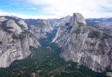
**Driving in: Once you’re in the valley first drive to inspiration point. You take the road as if you are going to wawona Hwy 41 and pull off before you get to the tunnel. If you can pull into bridal veil parking and walk the short distance to the base. Then head into the heart of the valley. Stop at the church and see if you can go inside. Not sure if they keep it locked. Great views just before the church of Yosemite falls. Park and look around. Go to base of Yosemite falls. Walk to mirror lake or maybe mirror meadow. Depends on the water right now. If you have time hike to vernal falls. Drive to glacier point.
**Mist trail/Nevada falls
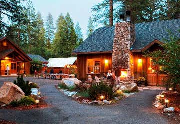
**Ahwahnee
**Bike trip around meadow- half day or longer
Tioga Road Also known as Highway 120, Tioga Road runs east to west through the center of Yosemite National Park’s high country, north of its main hub in Yosemite Valley. The highway’s highest point, Tioga Pass, reaches 9,943 feet into the sky. Understandably, that means that the road is shut down for large portions of the year depending on how much snow got dumped in the colder months. But getting that high (without having to hike it) offers a real treat as far as views go. Several gorgeous hikes and rest areas start from the road, and while you’ll certainly have company, it’s not quite as crowded as Yosemite Valley.
Lone Pine, CA, United States
