
8:30a ARRIVAL at Keflavík International Airport Get Rental, start Reynisfjara Run

8:30a ARRIVAL at Keflavík International Airport. Museum is at Airport...waypoint
Suðurstrandarvegur, Grindavík, Southern Peninsula
2 Miðgarður, Grindavík, Southern Peninsula

12:30 ARRIVAL 65 mi 1h 27m Drive This 0.9-mile loop trail is near Grímsnes- og Grafningshreppur.Generally considered an easy route, it takes an average of 23 min to complete. Kerið is an exquisite crater not far outside of the classic Golden Circle route that is a must-see for anybody to explore on their way out of Reykjavík. The 55 metre deep crater is 3000 years old, and is part of the larger Tjarnarhólar area, a collection of crater-hills. The Kerid crater lake is a 3000 years old volcanic crater lake that is part of the Golden Circle and located in the Grímsnes area. The lake is shallow and really depending on rainfall. The water is incredibly blue and the hike is easy to access to this spectacular view in the Grímsnes area in the south of the country.

2:00p ARRIVAL 53 mi 1h 9m Drive 1.2-mile out-and-back trail near Þórsmerkurvegur, Southern. Generally considered an easy route, it takes an average of 35 min to complete. Seljalandsfoss Waterfall One of Iceland’s most visited waterfalls, after Gullfoss, Seljalandsfoss is situated along the Seljalandsá river where the waterway plummets 40 metres over a cliff face. Seljalandsfoss is unique among waterfalls, as the shape of the cliff over which it falls allows visitors to walk behind the chute via a footpath at the base of the falls. You can get to the waterfall from the Seljaland farm along the Ring Road. A little further to the west there are several other falls, among them the fascinating Gljúfrabúi.

3:00p ARRIVAL 19 mi 0h 25m Drive Nearby is the Skógar Folk Museum, which boasts an array of interesting artifacts including an original turf farm that shows how people lived hundreds of years ago.

4:00p ARRIVAL 22 mi 0h 30m Drive Stop and have lunch. Check into AirBnB, nap
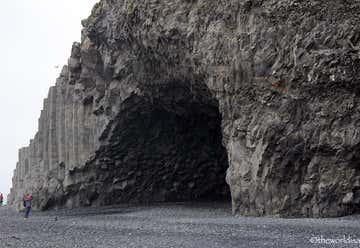
6:00p ARRIVAL walking distance 0.8-mile out-and-back trail near Mýrdalshreppur, Southern. Generally considered an easy route, it takes an average of 15 min to complete. Reynisfjara is without a doubt the most famous beach in all of Iceland, and you’ll see it featured on postcards and brochures throughout the country, as well as on pretty much any travel blog or video about Iceland. What sets Reynisfjara apart from all the rest are its black volcanic sands, smooth pebbles, unique rock formations, overall moody atmosphere and—more on this below—huge waves crashing on the shore. From the beach you have a view to the Reynisdrangar sea stacks. These bizarre looking rock pillars are said to be petrified trolls that were caught outside at sunrise and frozen in time, but some strongly believe that they’re actually basalt columns that were once part of the extensive shoreline cliffs.

8:00a ARRIVAL 7 mi 0h 13m Drive Vík, a town with approximately 300 inhabitants, an official trading post since 1887. Vík attracts a great number of tourists year-round, who come to experience its famed natural beauty and mild climate. A large arctic tern nesting colony is located west of Vík, while Mt. Reynisfjall, to the west, is home to a vast number of bird species, including puffin, fulmar and kittiwake. A great diversity of flowers and grasses may be found on the eastern side of Mt. Reynisfjall, the most extensive in one place in all of Iceland. The entire area area is perfect for nature lovers and many lovely hiking paths exists in Vík and its surrounding regions.
Holt, Skaftárhreppur, Southern

10:00a ARRIVAL 43 mi 0h 50m Drive 2.0-mile out-and-back trail near Skaftárhreppur, Southern. Generally considered an easy route, it takes an average of 1 h 2 min to complete. Enjoy Skaftafell, part of the immense Vatnajökull National Park and a place of great natural beauty with many interesting hiking trails, including a short path to the beautiful Svartifoss waterfall. This area is also full of opportunities for more adventurous pursuits, such as guided glacier-walking or ice-climbing excursions. Then, head to the amazing Jökulsárlón Glacier Lagoon

11:30a ARRIVAL 35 mi 0h 42m Drive 0.8-mile loop trail near Hornafjörður, Eastern. Generally considered an easy route, it takes an average of 14 min to complete.Near Jökulsárlón you will find the Diamond Beach, where chunks of ice wash ashore and are scattered like huge diamonds glistening against the stark black sands. The beach is spectacular any time of year, but especially magical when the sun is shining. Spend some time here to roam the beach and enjoy this unique setting right next to the glacier lagoon.

2:00p ARRIVAL 77 mi 1h 31m Drive 2.0-mile out-and-back trail near Skaftárhreppur, Southern. Generally considered an easy route, it takes an average of 52 min to complete. Fjaðrárgljúfur is a fantastic canyon located in the south-east part of Iceland close to the ring-road near to Kirkjubæjarklaustur. The river Fjaðrá flows through it. The canyon has winding water and steep walls. Stunning canyon landscapes view beautiful viewpoints.
9:00a ARRIVAL 45 mi 0h 52m Drive 0.4-mile out-and-back trail near Skaftárhreppur, Southern. Generally considered an easy route, it takes an average of 8 min to complete. Located along the Ring road between Vík and Höfn, Kirkjubæjarklaustur is a small village with just 120 people but a wealth of natural attractions, including Kirkjugólf, Eldgjá, the Laki craters and Fjaðrárglúfur canyon. The village is believed to have been settled by Irish monks before the arrival of Norse settlers in Iceland, and was the location of a Benedictine convent from 1186 through to the reformation in 1550. Many of the local folklore revolves around good and sinful nuns from this period.

3:30p ARRIVAL 57 mi 1h 12m Looming over the Reynisfjara black volcanic beach is Dyrhólaey, a 120-metre high promontory jutting out into the Atlantic Ocean. It’s a spectacular sight to behold with its natural arch and prominent hole, sculpted over millennia from the force of the waves. Owing to its unique shape, its Icelandic name translates to “door hill island”. Though you can get a lovely view of Dyrhólaey from the beach, you can also drive up to the top for a different perspective over the area and to get a photograph with the century-old lighthouse. Want to see puffins? This is a great spot in summertime for viewing the abundant seabirds that call the cliffs home. Just keep in mind that the puffins need a little privacy during their nesting season, so access to the top is closed each year around May and June.
1 Steinar, Rangárþing eystra, Southern

5:30p ARRIVAL at our Tower AirBnB 69 mi 1h 39m Drive

8:00a ARRIVAL 24 mi0h 36m Drive 1.2-mile loop trail near Bláskógabyggð, Southern. Generally considered an easy route, it takes an average of 43 min to complete. Strokkur is Iceland’s most visited active geyser and it's located in the Geysir Geothermal Area, titled after the Great Geysir, which lent its name to all others across the world. It is the greatest active geyser on site; Geysir itself is in a period of inactivity. Strokkur erupts more regularly than Geysir ever did, blasting water to heights of around fifteen to twenty metres every five to ten minutes. Just spectacular. You will also discover the Blesi hot spring that is one of the main hot springs in the Geysir area, above Geysir and Strokkur to the west.

9:00a Arrival 6 mi 0h 10m 1.3-mile out-and-back trail near Bláskógabyggð, Southern. Generally considered an easy route, it takes an average of 29 min to complete. Gullfoss is one of the most popular tourist attractions in Iceland. Gullfoss, or the ‘Golden Waterfall’, is a breathtaking two-tiered waterfall that drops 32 metres into a narrow canyon 70 metres deep and 2.5 kilometres long. From the car park there’s a footpath leading to a viewing platform where you can experience the waterfall in all its glory.

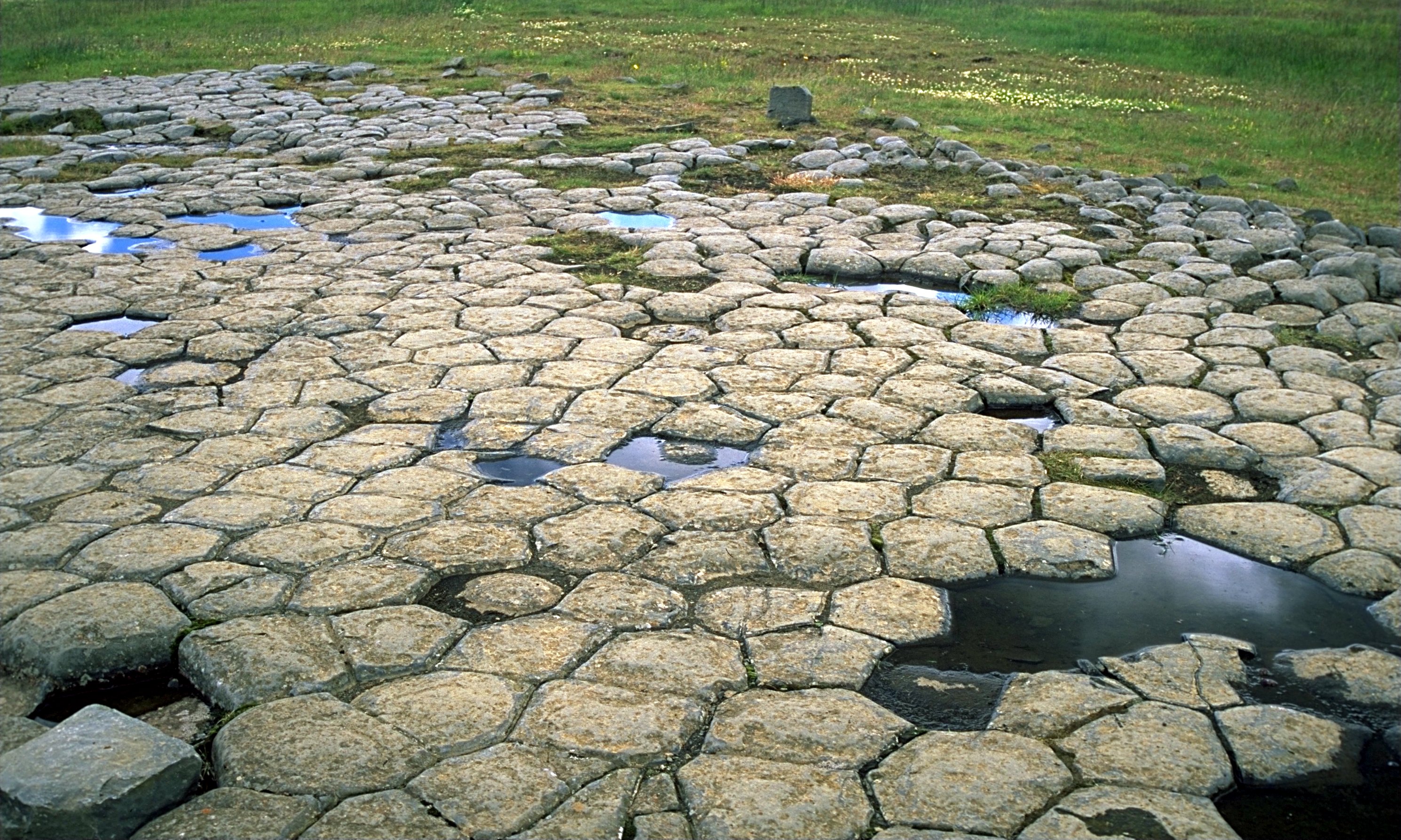
11:00a ARRIVAL 43 mi 1h 3m Drive 4.7-mile loop trail near Kjósarhreppur, Capital. Generally considered an easy route, it takes an average of 2 h 20 min to complete. Þingvellir National Park, a UNESCO World Heritage Site. Þingvellir has been the site of many special moments in history. The Icelandic parliament, The Althingi, was established here around 930 AD and on 17 June 1944, Icelanders celebrated their independence from Denmark in Þingvellir.
6:30a Fly to London
Banner Photo Credit: Todd
