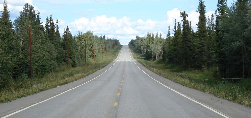


There are few road trips as grueling as the Alaska Highway. Traversing 1,700 miles of rugged wilderness from British Columbia, through Yukon Territory and into Alaska, it was one of the first roads to connect the US to Alaska. Though talk of building the highway dates back to the 1920s (a man named Slim Williams promoted the idea by traveling the route through unmapped territory in a dogsled with wolf-dogs), it wasn't until 1942, shortly after Pearl Harbor put the West Coast on high alert for attacks from Japan, that the highway was approved. It took 30,000 men only nine months to build the massive highway. In the 1980s, the entire road, both the Canadian and Alaskan portions, was entirely paved. Despite the remote location, few and far between stops along the way, and occasionally rough conditions, it's still a popular route for the adventurous to conquer. Those who do master the highway, though, will be treated to views of untouched nature, friendly small towns, old riverboats, mysterious deserts and even a hot spring or two.

1
Alaska Highway House
Start at Milepost 0 in Dawson Creek, BC. It's great photo op, adorned with flags. Across the street is the Alaska Highway House, a local museum dedicated to the construction of the road. You'll see how those 30,000 men fought through ice and mud to get the road completed, and how it affected the little towns along the way. They also do hourly showings of the PBS documentary made about building the highway. Dawson Creek itself was a town with a train station so it has plenty of amenities and accommodations, along with a few other things to see and do as well.

2
Fort Nelson Heritage Museum
Check out an impressive collection of antique construction equipment used to build the highway (among other things) at the Fort Nelson Heritage Museum. It's a fun hodge-podge collection, mostly made up of stuff from Fort Nelson Local Marl Brown. You'll also find old log cabins, old license plates, vintage oil derricks, antique hand tools, and taxidermy (including a rare albino moose!) They also feature works from local artists and have a cafe in an A-frame cabin onsite that serves ice cream and other treats.

Once the Alaska Highway was built, it provided easy access to the wonders of the remote, northern reaches of Canada. Wonders like steamy mineral hot springs. There are two springs here: The Alpha Pool, which is more shallow and warm, and the cooler, deeper Beta Pool. The Beta Pool is permanently closed (for now, at least) due to bear traffic. There's an observation deck over the Alpha pool with a raised walkway leading around the park (so visitors don't disturb the muskeg in the swamp), plus a changing room, outhouse, and playground. If you decide to take a dip in the pool, be sure to swim by the little waterfall for a natural shoulder massage as you soak in all the mineral goodness. They've also got camping, hiking, and biking, in case you want to work up a sweat before taking a dip in the spring. If you still want to take advantage of the benefits of chilling out in a hot spring but don't like roughing it, then you're in luck-- the lovely Liard Hotsprings Lodge is located right near by! The gorgeous rustic hotel is a 10-minute walk away from the pools. f you do most of your park-visiting during the summer, think again! Liard River Hot Springs is a great destination year-round: during the warmer months you can spot moose and bears and 14 kinds of orchids (which are the reason the park was known as the "Tropical Valley") but the place is downright magical in winter. Everything is calm and peaceful and shrouded in steamy mist-- plus nothing beats jumping in a hot spring and relaxing on a crisp, cold day!

Usually, a signpost is a welcome sight-- they're supposed to tell you which way to head to get to various cities, and how far away from them you are. But what started as an innocent signpost in Canada's Yukon Territory grew into a massive forest of signposts, with more directional posts and signs than any one person could sort through. The story of how it grew from one to hundreds all goes back to... yep, you guessed it. The Alaska Highway. The first signpost was erected by a Private named Carl Lindley in 1942. He was an engineer and had been working on building the Alaska Highway when he was injured, so he was taken to a nearby military base to recover. One of his tasks while recovering was to rebuild and repaint the directional signpost along the small road where the air base was. Just for fun, Lindley decided to add a directional marker towards his hometown, Danville, IL. Others on the base decided to add directional markers towards their hometown and other landmarks, and additional signposts were added.
Since then, Lindley's original "Danville" sign has been lost to time, but it doesn't matter too much: there are acres upon acres of signposts covered top to bottom in all kinds of signs. Street signs, road signs, license plates, handmade notes, and more fill the Sign Post Forest. There are reportedly 100,000 signs, and that number is constantly growing, as visitors are encouraged to contribute to the display. And if you're a sucker for history, you'll be happy to know that in 1992, while honoring the anniversary of the Alaskan Highway, Lindley and his wife returned to the sign forest, and he donated a replica of the "Danville" sign to the forest's visitors' center. After his time in Canada, he had returned to Danville, and spent the rest of his life in his beloved hometown that inspired the signpost forest!

5
Teslin Tlingit Heritage Centre
Stop by the Teslin Tlingit Heritage Centre to learn all about the people who lived here in the Yukon Territory well before the highway came through. Tlingit culture is alive and well here, and it's more than just a museum and shop with art and artifacts from their history; the centre is actively working to promote and preserve their way of life as well. The first thing you'll notice are the poles out front; the website says that these "represent the five Clans in which Teslin Tlingit Council society remains firmly rooted: Kùkhhittàn (Raven Children), Ishkìtàn (Frog), Yanyèdi (Wolf), Dèshitàn (Beaver), and Dakhł΄awèdi (Eagle). These poles symbolize the elements of land, water and air." Inside the building (designed by local Yukon architects) you can see traditional and modern Tlingit art and browse through unique and one of a kind gifts at the store.

Probably the last thing you'd expect to find way north is a desert, but against all odds, the Carcross Desert remains. At one mile square, it's often referred to as the world's smallest. The sand comes from glacial lakes filled with silt during the last Ice Age, and when the lakes dried up, a patch of dunes was left behind. Today, wind carries sand from nearby Bennett Lake to Carcross. Quite like a real desert, the Carcross Desert is quite a bit drier than the land around it, getting far less rain each year thanks to what's referred to as a "rain shadow effect" caused by the local mountains. Thanks to this weird geological quirk, numerous rare species of plans have been able to grow in the dunes, including Baikal sedge, an Asian plant that is only known to exist in four other sites in North America. The Yukon Territorial government actually tried to deem the tiny desert a protected area way back in 1992 but were successfully defeated by sand boarders, of all people. Turns out, the sandy slopes make for some sick boarding. Even still, the Carcross Desert is pretty well taken care of, and makes a great place for a hike, a picnic, and even provides some pretty awesome skiing in the winters.

Roads and trains and dog sleds weren't the only forms of transportation important to this remote wilderness; riverboats played a major role as well. Throughout history, there have been two S.S. Klondikes, one that lasted from 1929-1936 (when it ran aground) and the one that survives today, which was built in 1937 and operated until 1950-- the Klondike II was made from cannibalized wreckage of the Klondike I. They both ran freight between Whitehorse and Dawson City. Between 1950 and 1955, the Klondike II served as a cruise ship before the venture was abandoned and she was beached in Whitehorse. It was donated to the Canadian Parks Service in the 1960s, and they moved it to its current location (using 3 bulldozers, 12 men, and 8 tons of Palmolive soap), where it was restored and opened as a National Historic Site.

The Alaska Highway skirts the edge of Kluane National Park, and since you're nearby, you might as well pop in for a visit. Everything about this lesser-known park is just incredible. It's not just home to mountains, it's also home to Mount Logan, the highest peak in Canada, and the second-highest in North America; it's not just home to lush and green valleys, it's home to the greatest diversity of plant and wildlife in northern Canada; it's not just a National Park, it's also part of a UNESCO World Heritage Site and the world's largest international protected area, along with Wrangell-St. Elias, Glacier Bay, and Tatshenshini-Alsek Provincial Park. Whew. There are hotels and campsites nearby, and you can take a guided hike, ride on a dog sled, take a snow mobile trip, canoe, and more through this beautiful slice of Canada.

8
Fast Eddy's Restaurant
Stop in Tok, Alaska, to celebrate finally reaching The Last Frontier. Tok is a good place for a relaxing day, since there are some hotels and restaurants around town. Fast Eddy's Restaurant is a local favorite. Slide into a booth and enjoy steak, burgers, seafood (from salmon to crab), and more. The salad bar, with plenty of fresh fruits and veggies, will be a welcome sight. You can also enjoy a beer from Alaskan Brewing Co. with your meal!

9
Big Delta State Historical Park
The Alaska Highway technically ends in Delta Junction, and there's no better place to end it than at Big Delta State Historical Park. The centerpiece of the park is Rika's Roadhouse, a beloved local institution that provides a lot of insight into what Alaska was like back in the early 20th century. Rika Wallen was a Swedish immigrant hired to run a roadhouse on the historic Valdez-to-Fairbanks Trail in 1917. She catered to gold stampeders, hunters, traders, freighters, and other adventurers, and it was quite an exciting place to be at the time. She closed it down in the 1940s, and the state acquired the land and the building. It's been furnished with 1920s/1930s period pieces, and you can tour the roadhouse today. The park also has a museum, and Rika's Roadhouse Cafe and Gift Shop, where you can grab some homemade pie and browse local Alaska wares.
Tips for driving the Alaska Highway: You'll definitely need a passport (of course), and you'll want a spare tire as well. Just in case; the roads are mostly pretty well cared for, and you can take basically any car on it, but since it's so remote, you'll want to come prepared. Cell service is very spotty, and you'll want to keep an eye on your gas and top off whenever you can, just in case. Call ahead for hotels and campgrounds whenever you can as well. You'll find that more things are open, and are open for longer, during the summer, so even though the road is more crowded then, it's the best time to go. You'll also get lots of daylight! You can drive it in the winter, but it's a little tougher then.
Roadtrippers
Roadtrippers helps you find the most epic destinations and detours—from roadside attractions to natural wonders and beyond.
Explore More Trip Guides
- Trip Guide
The real places that inspired Gilmore Girls' Stars Hollow
- 12 Places
- 02:03
- 69 mi
- Trip Guide
How To Visit The Real-Life Overlook Lodge From "The Shining"
- 15 Places
- Trip Guide
The best places to hook up with a ghost
- 9 Places
- Trip Guide
California SR25: The Airline Highway
- 14 Places
- 05:41
- 213 mi