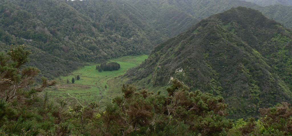
“The Atene Skyline Track has spectacular views and a campsite for trampers wanting to stay the night.”
6-8 hours loop track.
Beginning at the up-river end, the track climbs steeply from the River Road to a height of 260 m through fine lowland forest. Following an old, gently graded roadline for approximately 3 km the track follows the ridgeline to a clearing which marks the track's halfway point. A campsite with drinking water, a shelter and a toilet is available here.
Shortly beyond this point is the Taumata Trig, the highest point of the track at 572 m. The track then winds around the edge of sandstone bluffs to reach Taupiri Trig before descending steeply back to the River Road.
The focus throughout the walk is Puketapu hill. Many hundreds of years ago the hill stood at the end of a long, narrow-necked peninsula. The river once flowed in an almost complete circle around Puketapu but after years of erosion the river broke through the neck, forcing a more direct route to the sea and cutting off the meander.
Spectacular views from vantage points along the track include the cut-off meander, the Whanganui River, Mt Ruapehu, Mt Taranaki/Egmont, the Tasman Sea, and the Whanganui River's tributary valleys.
Reviews
Be the first to add a review to the Atene Skyline Track.
/175.1543698454,-39.726350129447,14/300x172@2x?access_token=pk.eyJ1Ijoicm9hZHRyaXBwZXJzIiwiYSI6ImNsdjQ5N2VtZDA2bW8ycW13ZHAxeGhjbjkifQ.UIccpoAxc7g3BAuK4s9vjg)
Atene Skyline Track
Hours
- Sun - Sat: 12:00 am - 11:59 pm
Problem with this listing? Let us know.
Has RV parking changed? Let us know.
-
Parking
-
Pets Allowed
-
Restrooms
-
Wifi
-
Wheelchair Accessible
-
Credit Cards Accepted
Parking
Nearby Hotels
Related Trip Guides
Manawatu's Best Short Walks
- 4 Places
Wellington to Gisborne Long Weekend Roadie
- 18 Places
- 19:22
- 826 mi
Cycle The Otago Central Rail Trail
- 34 Places
- 04:20
- 169 mi
Great Alpine Highway
- 29 Places
- 10:42
- 414 mi
