“View the walking tracks in the Lake Rotoiti area of Nelson Lakes National Park.”
Bellbird Walk
Time: 15 min
This short, wheelchair-standard walk gives an introduction to the Rotoiti Nature Recovery Project area.
This sheltered corner of the lake attracts nectar-feeding birds such as tūī and bellbirds to the large red beech trees that dominate this area. Listen for their enchanting calls as you take this walk. Keep an eye out for other insect-eating forest birds as well. The deciduous New Zealand fuchsia, which is rare in much of the forest due to browsing by possums, may be seen in several places along this walk. The pathway returns through a small wetland area where sedges, rushes, ferns and mosses thrive.
As you walk along the path, you may see traps and/or toxin bait stations – do not touch these as they are important to the work of Rotoiti Nature Recovery Project and may contain poison or cause injury.
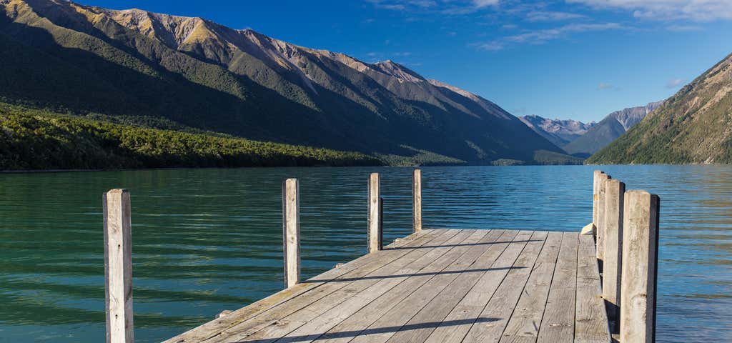
The track begins at the car park near the east jetty at Kerr Bay. Allow 5 minutes walking time for this as well as 10 minutes or so to read the information panels along the way.
Black Valley Walk
Time: 30 min one way
This walk starts near the Kerr Bay campground and follows the Black Valley Stream through majestic beech forest.
The walk runs parallel to State Highway 63 ad has three entry/exit points along the way that lead off to the Rotoiti Chapel, the village store and Bridge Street.
Brunner Peninsula Nature Walk
Time: 1 hr
Beginning at the western side of Kerr Bay below the Visitor Centre, this walk follows the peninsula around into West Bay, twice crossing the Alpine Fault.
Return via Baxter Street or Cotterell Street and View Road.
Panels along the way give an insight into the history of the area.
For a longer walk (1 hr 30 min) continue to the next junction and turn right, returning to Kerr Bay via Rotoiti Lodge and Ward Street. This walk has a good variety of native plants and several easy access points to the lakeshore.
Honeydew Walk
Time: 45 min
This walk takes you further into the Rotoiti Nature Recovery Area along a high-standard track.
The Honeydew Walk branches off the Bellbird Walk, which begins at the car park near the east jetty at Kerr Bay.
There are several information panels along this track, which provide information on the recovery project. Allow 35 minutes walking time plus 10 minutes to read the information panels along the way.
The surface is suitable for wheelchairs but would need someone to push on the steeper slopes.
Anglers Walk
Time: 1 hr
This walk begins by the Buller River Bridge on Mt Robert Road just below the river's lake source.
The track follows the northern river bank where there are several good spots for trout fishing.
This walk makes a pleasant extension to Moraine Walk and the circuit can be completed by returning along SH63.
Note: A fishing licence is required for fishing rivers and lakes in New Zealand. Eel fishing is prohibited in the lakes and rivers of the national park.
Black Hill Walk
Time: 1 hr 30 min return
This walk begins at Rotoiti Lodge and climbs through beech forest and stands of manuka and kanuka to a viewpoint at Black Hill – a solid mound of volcanic rock. Near the top is a clearing from which St Arnaud Village and Big Bush can be viewed.
The track descends steeply to the highway and follows it back to Rotoiti Lodge Road.
This walk can easily be linked to the Brunner Peninsula Nature Walk or Moraine Walk to make a half-day excursion.
Loop Track
Time: 1 hr 30 min return
Beginning in the eastern corner of Kerr Bay, the Loop Track takes you well into the Rotoiti Nature Recovery Project area.
Start the track by taking the Bellbird Walk and Honeydew Walk before turning left to follow the St Arnaud Range/Loop Track.
From here, the track climbs a series of terraces to a junction at a creek and then loops back and down until you re-emerge at the lakeshore and join the Lakehead Track, which returns to the car park.
The track is likely to be a bit muddy after rain.
Moraine Walk
Time: 1 hr 30 min return
This walk begins at the junction of SH63 and Rotoiti Lodge Road. It winds around the base of Black Hill, over piles of moraine debris left by the ancient Travers Glacier, and past kettle ponds created when blocks of ice surrounded by glacial gravel melted away.
The walk passes through the back of West Bay campground and on to the Buller River.
Reviews
Be the first to add a review to the Lake Rotoiti Walking Tracks.
/172.84689366119,-41.806781222691,14/300x172@2x?access_token=pk.eyJ1Ijoicm9hZHRyaXBwZXJzIiwiYSI6ImNsdjQ5N2VtZDA2bW8ycW13ZHAxeGhjbjkifQ.UIccpoAxc7g3BAuK4s9vjg)
Lake Rotoiti Walking Tracks
Hours
- Sun - Sat: 12:00 am - 11:59 pm
Problem with this listing? Let us know.
Has RV parking changed? Let us know.
-
Parking
-
Pets Allowed
-
Restrooms
-
Wifi
-
Wheelchair Accessible
-
Credit Cards Accepted
Parking
Nearby Hotels
Related Trip Guides
- Trip Guide
Nelson & Tasman Area Walks
- 7 Places
- Trip Guide
Wellington to Gisborne Long Weekend Roadie
- 18 Places
- 19:22
- 826 mi
- Trip Guide
Cycle The Otago Central Rail Trail
- 34 Places
- 04:20
- 169 mi
- Trip Guide
Great Alpine Highway
- 29 Places
- 10:42
- 414 mi