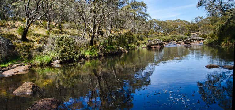
“Aeroplane Hill walking track offers scenic views, wildlife, and wetlands in the sub-alpine region of Barrington Tops National Park, between Scone and Gloucester.”
Walk with your head in the clouds on this high country track through the plateau region of Barrington Tops National Park. Located between Scone and Gloucester at an altitude of 1,500 metres, you’ll be walking through a unique sub- alpine environment unlike anything else you'll find in NSW. Set out from Junction Pools campground on the Aeroplane Hill walking track. Take in the scenic woodlands and wetlands before arriving at Careys Peak lookout where you’ll be treated to views out to the coast. Head on to Barrington River, through fields of grass covered in patches of snow. This area is a haven for some threatened species of plants and wildlife such as the broad-toothed rat and some rare types of orchids. Make sure you check out the weather report before venturing out - the track is sometimes closed in heavy snow, ice or rain. It’s also best to prepare for four seasons in one day as the weather can change rapidly at this high altitude - so hat, water, sunblock and something warm to wear.
Reviews
Be the first to add a review to the Aeroplane Hill walking track.
/151.4432,-32.0306727,14/300x172@2x?access_token=pk.eyJ1Ijoicm9hZHRyaXBwZXJzIiwiYSI6ImNsdjQ5N2VtZDA2bW8ycW13ZHAxeGhjbjkifQ.UIccpoAxc7g3BAuK4s9vjg)
Aeroplane Hill walking track
Hours
Problem with this listing? Let us know.
Has RV parking changed? Let us know.
-
Parking
-
Pets Allowed
-
Restrooms
-
Wifi
-
Wheelchair Accessible
-
Credit Cards Accepted
Nearby Hotels
Related Trip Guides
New South Wales Best Day Walks
- 10 Places
Hobart - Swansea Weekend Roadie
- 16 Places
- 08:30
- 315 mi
Explore The SouthWest
- 46 Places
- 51:16
- 2,083 mi
