“Fly a Kite in York”
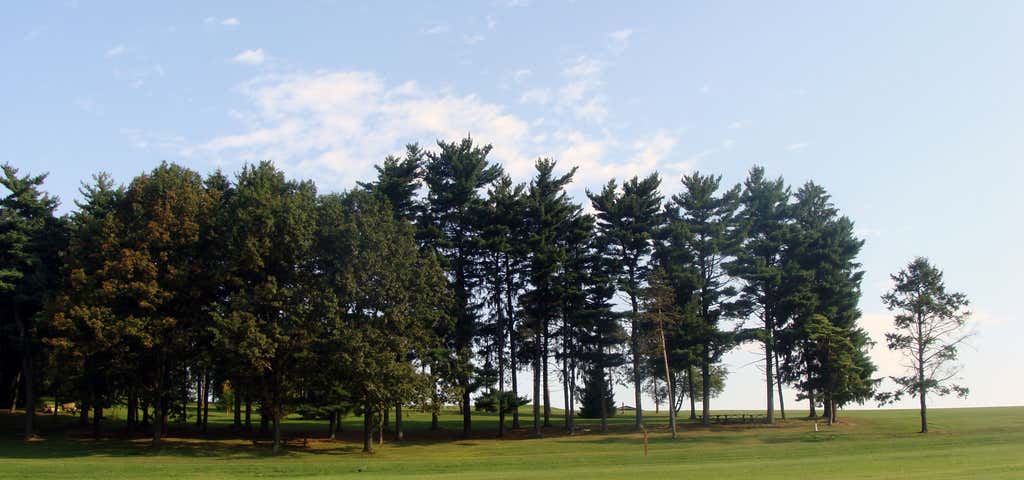
This 85-acre state park is dominated by Mt. Pisgah, an 885-foot high ridge that separates Kreutz Creek Valley and East Prospect Valley. The park landscape also consists of mowed grass fields on the northern and eastern park slopes, a pine plantation in the southern area and mature woods in the western section. Samuel S. Lewis State Park was named to honor the Secretary of the Pennsylvania Department of Forest and Waters from 1951-1954. Samuel S. Lewis donated 35 acres of his farm to the Commonwealth in 1954. Lewis convinced Walter Stine to sell his arboretum to the Commonwealth for a reasonable price. The Commonwealth then purchased an additional 35 acres of the adjacent Almoney Farm to complete the initial park tract. The park opened to the public on July 4, 1954. The Department of Conservation and Natural Resources purchased an additional 14 acres of land in 1999. This unassuming, jovial, analytical man held several cabinet-level positions to several governors, most notably as Secretary of Highways to Governor Gifford Pinchot during Pinchot’s ambitious road-paving program to “get the farmer out of the mud.” Samuel Lewis was the lieutenant governor to Arthur H. James from 1939 to 1943. Lewis was the postmaster general of York and rejuvenated the York Fair. In 1951, Lewis was appointed the Secretary of the Department of Forests and Waters and oversaw all state parks and forests. In two years, Lewis reorganized and streamlined the department. "Sam Lewis was the best man I ever worked under. He was a genius at deciding what was good for the public and getting it done quickly. He had the administrative tools to get anything done." Joe Ibberson, retired division chief, Bureau of Forestry
Reviews

Views of the Susquehanna River, the longest river on the East Coast, is the best view in Pennsylvania. It’s a rewarding view after trekking the 1.6-mile Hilltop Trail through the Samuel S. Lewis State Park.
Trek through the shaded trees sitting on the mountain ridge cutting through the Kreutz Creek Valley and East Prospect Valley. The trail ends at the top of Mt. Pisgah, the park’s highest point at 885 feet. The summit is an inviting grassy space with prominent views of the river and surrounding mountains. You’ll be accompanied by other hikers gawking at the views and civilians flying colorful kites overhead.
The trail is moderate, so everyone has a chance to witness the mountaintop viewpoint. Plan for about an hour to finish the loop trail.
We think a visit here is one of the best things to do in York, PA!
Be the first to add a review to the Samuel S. Lewis State Park.
/-76.548101,39.995763,14/300x172@2x?access_token=pk.eyJ1Ijoicm9hZHRyaXBwZXJzIiwiYSI6ImNsdjQ5N2VtZDA2bW8ycW13ZHAxeGhjbjkifQ.UIccpoAxc7g3BAuK4s9vjg)
Samuel S. Lewis State Park
Hours
Problem with this listing? Let us know.
Has RV parking changed? Let us know.
-
Parking
-
Pets Allowed
-
Restrooms
-
Wifi
-
Wheelchair Accessible
-
Credit Cards Accepted
-
Outdoor Seating
Parking, Dining
Nearby Hotels
Related Trip Guides
- Trip Guide
Pay Tribute and Reflect at These US Monuments and Memorials
- 14 Places
- Trip Guide
The top things to do on an I-95 road trip
- 50 Places
- 41:46
- 1,983 mi
- Trip Guide
The top things to do on an East Coast road trip
- 32 Places
- 48:54
- 2,584 mi
- Trip Guide
The top things to do on an I-80 road trip
- 35 Places
- 53:41
- 3,194 mi