“Discover Vermont's Mountain Splendor!”
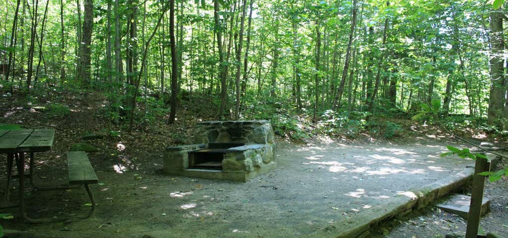
Underhill is within Vermont's 39,837-acre Mt. Mansfield State Forest. On the headwaters of the Brown's River, at about 2,000 feet elevation, the park lies on the west slope of 4,300 feet Mt. Mansfield, the state's highest peak. Just over the summit ridge is the Stowe ski area, one of North America's original ski resorts. The elevation and corresponding exposure to harsh climatic conditions have resulted in some relatively unusual vegetation types along the mountain's summit ridge. The low, stunted-plants found in the alpine tundra near the summit, very rare in New England, are more typical of types found on broad expanses of Arctic tundra a thousand miles farther north. These plants are fragile (if you hike to the summit, please stay on marked trails.) The park includes a log picnic shelter, built by the Civilian Conservation Corps or CCC, a nationwide public works program created during the great economic depression of the 1930’s to provide jobs and training for thousands of unemployed. Many state and national parks trace their origins to the CCC era. In addition, the park contains a small campground, picnic grounds, and a group camping area. The campground has a restroom facility with flush toilets and cold running water, but no showers. Due to the park’s hillside nature, it is not suitable for RVs or trailers. All campsites are walk-in. This off-grid park uses solar power for office functions, and to operate the water system. The group camping area consists of a small level field with 7 lean-to shelters and two tent sites, a 0.8 mile moderate walk uphill from the main campground. There is a pit toilet that serves the group area. The park is probably best known for its hiking. There are four trails to the summit ridge of Mt. Mansfield from Underhill State Park. Walking up the gated road from the park headquarters, the trails begin branching off shortly above the group camp area. The Sunset Ridge Trail, 3 miles to the summit, is the most popular. Vermont’s Long Trail traverses the summit ridge and, with several trails from the other side of the mountain, many loops are possible. Hiking information and trail maps are available at the park headquarters. The upper camp area, about 3/4 of a mile above the ranger station, has 7 lean-to sites and 2 tent sites and is reserved for organized group use. In the lower camp area, around the ranger station, are 11 tent sites and 6 lean-to sites. There is cold water and flush toilets in the rest rooms, but no showers. Because campers park in the lot and cannot drive the last several yards to their campsites, this park is not recommended for RV or tent-trailer campers.
Be the first to add a review to the Underhill State Park.
/-72.839,44.53,14/300x172@2x?access_token=pk.eyJ1Ijoicm9hZHRyaXBwZXJzIiwiYSI6ImNsdjQ5N2VtZDA2bW8ycW13ZHAxeGhjbjkifQ.UIccpoAxc7g3BAuK4s9vjg)
Underhill State Park
Hours
Problem with this listing? Let us know.
Has RV parking changed? Let us know.
-
Parking
-
Pets Allowed
-
Restrooms
-
Wifi
-
Wheelchair Accessible
-
Credit Cards Accepted
- Affiliation
- State park or forest
-
Fifty Amp
-
Full Hookup
-
Pull Through
-
Dump Station
-
Big Rigs
-
Open Seasonally
-
Age Restricted
-
Boondock
-
Cabin Sites
-
Dispersed Sites
-
Firewood
-
Fulltime Residents
-
Group Tent Sites
-
Laundry
-
Mobile Homes
-
Permit Required
-
Propane
-
Public Water
-
Pull Through RV Sites
-
Reservations
-
Sewer Hookup
-
Showers
-
Water Hookup
Campground, Restrooms