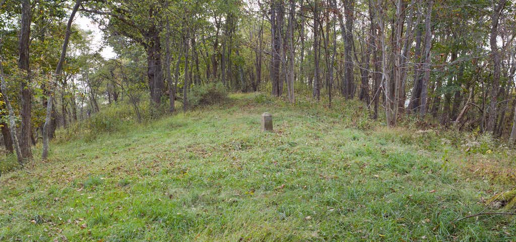
Mason and Dixon Survey Terminal Point is a historic marker located near Pentress, West Virginia, United States. Located on the boundary between Monongalia County, West Virginia and Greene County, Pennsylvania, it identifies the terminal station established by Charles Mason and Jeremiah Dixon on Brown's Hill on October 19, 1767. The stone placed on Brown's Hill in 1883 in the mound of 1767, marks the westernmost point reached by Mason and Dixon in delineating the common boundaries of Pennsylvania, Maryland, Delaware, and Virginia (now West Virginia), and known as the Mason–Dixon line. It was listed on the National Register of Historic Places in 1973. West Virginia Marker Face
Be the first to add a review to the Mason and Dixon Survey Terminal Point.
/-80.1186111111111,39.7211111111111,14/300x172@2x?access_token=pk.eyJ1Ijoicm9hZHRyaXBwZXJzIiwiYSI6ImNsdjQ5N2VtZDA2bW8ycW13ZHAxeGhjbjkifQ.UIccpoAxc7g3BAuK4s9vjg)
Mason and Dixon Survey Terminal Point
Hours
Problem with this listing? Let us know.
Has RV parking changed? Let us know.
-
Parking
-
Pets Allowed
-
Restrooms
-
Wifi
-
Wheelchair Accessible
-
Credit Cards Accepted
Nearby Hotels
Related Trip Guides
- Trip Guide
Pay Tribute and Reflect at These US Monuments and Memorials
- 14 Places
- Trip Guide
The top things to do on an I-95 road trip
- 50 Places
- 41:46
- 1,983 mi
- Trip Guide
The top things to do on an East Coast road trip
- 32 Places
- 48:54
- 2,584 mi
- Trip Guide
The top things to do on an I-80 road trip
- 35 Places
- 53:41
- 3,194 mi