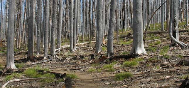

The Grouse Gap section of the Pacific Crest National Scenic Trail is an enjoyable easy day-hike close to the Rogue Valley. The trail offers wonderful displays of wildflowers in mid summer and outstanding vistas of Mount Shasta, the Marble Mountains and the Trinity Alps to the south. Several springs are found along the trail; however the water has not been tested and maybe unsafe to drink. Beginning at the Rogue River National Forest Boundary Sign on the Mount Ashland access road, the trail begins a gradual ascent along the Southern flanks of Mount Ashland passing through a mixed conifer forest. Interesting granite rock formations are seen along the edge of the trail. Small mountain meadows start to appear, gradually opening to a large cirque basin blanketed with columbine, scarlet, gilia, Indian paintbrush, lupines and mountain gentians. Deer are often seen in this area when flushed from cover in the cool shady draws. This section of the PCNST ends at Grouse Gap, and a nice loop can be completed by hiking along Forest Road #20 south, to the Mount Ashland Ski Area and back to your car via the access road. Picnic facilities are available at the Mount Ashland Picnic area, a half mile west of the ski area.
Be the first to add a review to the Pacific Crest National Scenic Trail (Forest Boundary to Grouse Gap).
/-122.6966542,42.0699753,14/300x172@2x?access_token=pk.eyJ1Ijoicm9hZHRyaXBwZXJzIiwiYSI6ImNsdjQ5N2VtZDA2bW8ycW13ZHAxeGhjbjkifQ.UIccpoAxc7g3BAuK4s9vjg)
Pacific Crest National Scenic Trail (Forest Boundary to Grouse Gap)
Hours
Problem with this listing? Let us know.
Has RV parking changed? Let us know.
-
Parking
-
Pets Allowed
-
Restrooms
-
Wifi
-
Wheelchair Accessible
-
Credit Cards Accepted
Nearby Hotels
Related Trip Guides
- Trip Guide
A road trip to filming locations featured in 'The Goonies'
- 6 Places
- 00:57
- 28 mi
- Trip Guide
Pay Tribute and Reflect at These US Monuments and Memorials
- 14 Places
- Trip Guide
The Ultimate Guide To Joshua Tree National Park
- 53 Places
- 11:44
- 408 mi
- Trip Guide
The top things to do on an I-40 road trip
- 35 Places
- 49:44
- 2,851 mi