

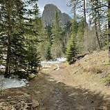
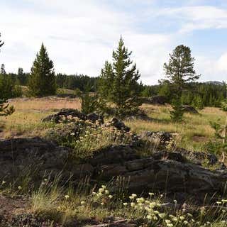
A 2.2 mile trail that includes two loop trails and a spur trail to an overlook.
The Osprey Trail was appropriately named because ospreys are often seen in the Pactola Lake area. Osprey, also known as fish hawks, are fish-eating specialists, with live fish accounting for about 99 percent of their diet. Osprey are spectacular divers. Once they have sighted their prey, they fold their wings tightly, descend swiftly and enter the water feet first, often submerging completely. Long sharp talons and barbed pads grip the slippery fish. The fish will be carried back to the nest headfirst to make it as aerodynamic as possible.
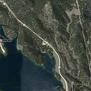
From Rapid City, travel about 15 miles west on Highway 44. Turn south (left) onto Highway 385 and continue for 2.7 miles. Just after the Pactola Visitor’s Center turn west (right) onto Custer Gulch Road. Wind along the lake, past the beach for 1.4 miles before you turn north (right) following the signs to Pactola Campground. Go all the way through to the end of the campground facility past the fee booth to the trailhead.
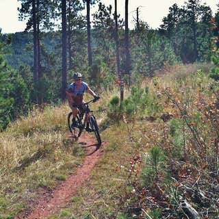
The Osprey Trail is maintained for hikers. No motorized use is allowed. Difficulty Rating: Easy.
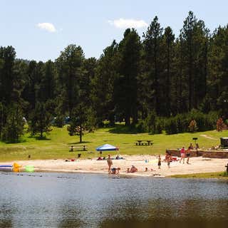
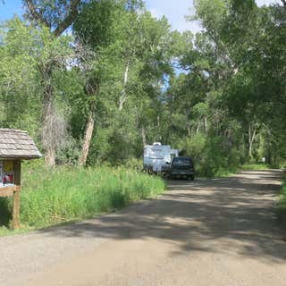
The Veterans Point Picnic Area has four picnic sites located along a paved trail. Accessible restroom facilities are available. An accessible fishing pier is located farther down the trail.
Directions:
To access Veterans Point from Rapid City, travel west on U.S. Highway 44 for approximately 15 miles to the junction with U.S. Highway 385. Turn south or left onto 385 and travel approximately one mile. The parking lot for the picnic area and trail is on the right, before you reach the dam.
From Rapid City, travel west on Highway 44 for about 15 miles. Turn north (right) onto Highway 385 and travel for 1.4 miles, then turn west (left) onto Silver City Road. Travel .25 miles, trailhead is on right. This trailhead offers access to the Centennial Trail as well as the eastern end of the Deerfield Trail (#40). This is the northernmost Trailhead on the Centennial Trail in the Central Hills (Mystic District).
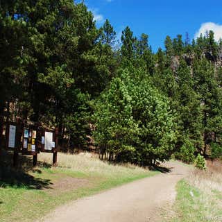
Pilot Knob trailhead is located on Forest Service Road 208. Traveling north, it provides motorized access to the Centennial Trail and traveling south it provides non-motorized access to the Centennial Trail. There is a restroom here but no water.
56 Sites, Tents Ok
Dry Camping
Vault Toilets
Potable Water
20 campsites, tents ok
Reservable
Water & Power
Dump Station
Cabins
Cafe
Showers
This is nice open meadow with plenty of camp spots all around the edges. Only problem is lots of ATV traffic. Quieter mid week but can be a problem on the weekends.
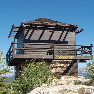
Formerly known as the High Park Lookout, it was renamed in honor of James Torrey Saban, who died in the line of duty in 1937 while fighting the Blackwater fire.
Beautiful overnight stay in the Big Horn Mountains. Off RT 14 scenic. Just at the crest of the mountain, drive a few miles down dirt road. Plenty of scenic spots. Quiet. Wish we Could have stayed longer! Seems like a perfect spot to just relax and enjoy the beauty. No facilities but there is a dump station just up the road. Highly recommend.
January 26, 2023
This campground hosts 16 sites next to the North Fork of the Shoshone River. This campground provides wonderful wildlife viewing and fishing.
16-day stay limit
Reservable
Water: Not available
This facility is not accessible to persons with mobility impairments.
No cell service
Notes: Maximum spur 32 feet.