“a lush Carolinian forest oasis”
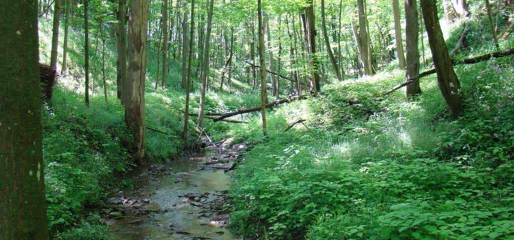
A lush Carolinian forest oasis at the southern tip of Canada, Point Pelee National Park resounds with migrating song birds in the spring, hums with cicadas in the summer, flutters with Monarch butterflies in the fall and is a peaceful place of reflection in the winter. Point Pelee National Park (/ˈpiːliː/; French Parc National de la Pointe-Pelée) is a national park located in Essex County in southwestern Ontario, Canada where it extends into Lake Erie. It consists of a peninsula of land, mainly of marsh and woodland habitats, that tapers to a sharp point as it extends into Lake Erie. Middle Island, also part of Point Pelee National Park, was acquired in 2000 and is located just north of the Canada–United States border in Lake Erie. Point Pelee is the southernmost point of mainland Canada, and is located on a foundation of glacial sand, silt and gravel that bites into Lake Erie. This spit of land is slightly more than seven kilometers long by 4.5 kilometres (2.8 mi) wide at its northern base. Established in 1918, Point Pelee was the first national park in Canada to be established for conservation. It was designated at a Ramsar site on May 27, 1987. Indigenous people lived on Point Pelee for many years before European colonization, dating back to at least 6,000 years. The largest archaeological site found at Point Pelee is thought to have been occupied between AD 700 and 900. Point Pelee was made a national park in 1918 at the urging of birdwatchers and hunters. Commercial fishing continued in the park until 1969. Point Pelee was the only Canadian national park to allow hunting until duck hunting was ended in 1989. This site was named "Pointe-Pelée" (meaning "bald point" by French explorers because the eastern side was rocky and had no trees. It forms the southernmost point in mainland Canada (its latitudinal position is the same as the northernmost counties of California) and is part of a bird and butterfly migration corridor over Lake Erie via Point Pelee and the Lake Erie islands. Over 360 bird species have been recorded in the park. The peak time for bird migration is spring, especially May, when tired migrants make first landfall after their journey north across the lake. Bird species include Cooper's Hawk, Painted Bunting, and Yellow Choochity Warbler. Many birdwatchers from North America and abroad visit the park in spring, often staying in the nearby town of Leamington. One attraction, apart from the sheer numbers and variety of bird passing through on migration, is the opportunity to see more northerly breeding species such as Blackpoll Warbler before they move on. Located in the western parts of the St. Lawrence Lowlands, the park is a sandspit formation that extends 15 kilometres (9.3 mi) into Lake Erie and is up to 70 metres (230 ft) thick.[6] With an area of only 1,564 hectares (3,860 acres), it is Canada's smallest national park. Most of the park (about 1,113 hectares (2,750 acres) or 70% of the park consists of marsh, dominated by cattails and ponds although forested areas make up a significant portion of the park, covering about 21% of the park.This sandpit is dominated by till plains which was formed during the last ice age during the advance and retreat of the Wisconsonian ice on a submerged limestone ridge. As the glacier melted and retreated northward, the Lake Erie basin began to fill with water. The movement of sediments altered the coastline, resulting in the present day shape of Point Pelee. Subsequently over the centuries, a thin but rich soil has formed. The marshes began to form about 3,200 years ago, based on carbon dating. This was also the same time when the sands began to deposit, forming the present day barriers. The marsh has a closed drainage system owing to the separation of it by two barriers along the east and west side, which usually prevents the free exchange of water. However, when lake levels are higher, the marsh water levels fluctuate with the lake's water levels. The distinctive triangular shape at the southern tip of Point Pelee is caused by the convergence of these two barriers. Middle island, which is located south of the Point Pelee peninsula has an area of approximately 18.5 hectares (46 acres) and is the southernmost point in Canada. Virtually all of Middle Island is forested.

Great place to see nature! The Marshall trail was our favorite. The willows were everywhere. The boardwalk lead right now the center of them. The lake was filled with birds, turtles, and fish. Another trail leads to the beach, this happens to be Canada's southern most point.
Be the first to add a review to the Point Pelee National Park.
/-82.517778,41.964167,14/300x172@2x?access_token=pk.eyJ1Ijoicm9hZHRyaXBwZXJzIiwiYSI6ImNsdjQ5N2VtZDA2bW8ycW13ZHAxeGhjbjkifQ.UIccpoAxc7g3BAuK4s9vjg)
Point Pelee National Park
Hours
Problem with this listing? Let us know.
Has RV parking changed? Let us know.
-
Parking
-
Pets Allowed
-
Restrooms
-
Wifi
-
Wheelchair Accessible
-
Credit Cards Accepted
Nearby Hotels
Related Trip Guides
- Trip Guide
Toronto to Tobermory: Exploring Ontario's shores and natural wonders
- 10 Places
- Trip Guide
Prince Edward Island: Tour this tiny island filled with big adventures
- 11 Places
- Trip Guide
Fort Providence: An idyllic town at the edge of civilization
- 10 Places
- Trip Guide
Explore Alberta's Rockies from Edmonton to Canmore
- 15 Places