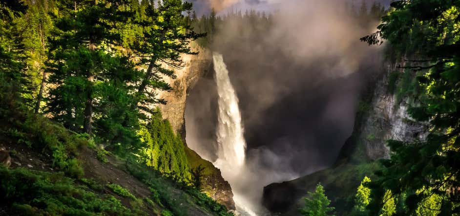
“4th highest waterfall in Canada”
Helmcken Falls is a 141 m (463 ft) waterfall on the Murtle River within Wells Gray Provincial Park in British Columbia, Canada. The protection of Helmcken Falls was one of the reasons for the creation of Wells Gray Provincial Park in 1939. Helmcken Falls is the fourth highest waterfall in Canada, measured by total straight drop without a break. Higher Canadian waterfalls are Hunlen Falls in Tweedsmuir Provincial Park, Takakkaw Falls in Yoho National Park, and Della Falls in Strathcona Provincial Park, all in British Columbia.There are six other waterfalls on the Murtle River, upstream from Helmcken Falls. The others are The Mushbowl, Dawson Falls, Majerus Falls, Horseshoe Falls, Meadow Falls and McDougall Falls. Only Helmcken, The Mushbowl and Dawson can be reached by road. Majerus, Horseshoe and McDougall Falls are accessed by trails . Meadow Falls is very difficult to view, except by air. Helmcken Falls was discovered in 1913 by Robert Lee, a land surveyor working for the British Columbia government. He was so impressed with the waterfall that he wrote a letter from his remote camp to Sir Richard McBride, Premier of British Columbia, requesting that the falls be named "McBride Falls". Three weeks later, Lee received a reply from the Premier stating that the waterfall was instead to be called Helmcken Falls. This name honoured John Sebastian Helmcken, a physician with the Hudson's Bay Company who arrived in Victoria in 1850. He helped bring British Columbia into Canadian Confederation in 1871. Dr. Helmcken died in 1920 at the age of 95, but never actually saw the falls himself. Brink Trail: A 4-km long trail starts near Dawson Falls and follows the south bank of the Murtle River to the brink of Helmcken Falls. This walk takes about an hour. There are no fences at the end of this trail so caution is important, especially with children and pets. Helmcken Canyon: A 30-minute walk west from the main viewpoint follows the rim of Helmcken Canyon to an overlook of the meeting of the Murtle and Clearwater Rivers, about 250 m (820 ft) below. Bottom of Helmcken Falls route: Continuing past the above overlook, the trail deteriorates into a strenuous scrambling route which descends into Helmcken Canyon, then follows the Murtle River to the bottom of the falls. This takes about four hours each way. Gattling Gorge trail: Gattling Gorge is the narrowest point of the Clearwater River, about 20 m (66 ft) across. It is at the head of Helmcken Canyon, upstream from the confluence with the Murtle River. A trail from the main Helmcken Falls viewpoint accesses this gorge but signage is poor. It takes about an hour to walk.
Reviews
These falls really are something spectacular! If your daring enough to make the trek out in the winter they freeze up really nicely for a super unique view not many people will get to see!
Review: Amazing!
The falls are super accessible. They are maybe a 60 s walk from the parking lot. There was few people around, which was nice. The view was stunning.
Be the first to add a review to the Helmcken Falls.
/-120.176911,51.954092,14/300x172@2x?access_token=pk.eyJ1Ijoicm9hZHRyaXBwZXJzIiwiYSI6ImNsdjQ5N2VtZDA2bW8ycW13ZHAxeGhjbjkifQ.UIccpoAxc7g3BAuK4s9vjg)
Helmcken Falls
Hours
Problem with this listing? Let us know.
Has RV parking changed? Let us know.
-
Parking
-
Pets Allowed
-
Restrooms
-
Wifi
-
Wheelchair Accessible
-
Credit Cards Accepted


