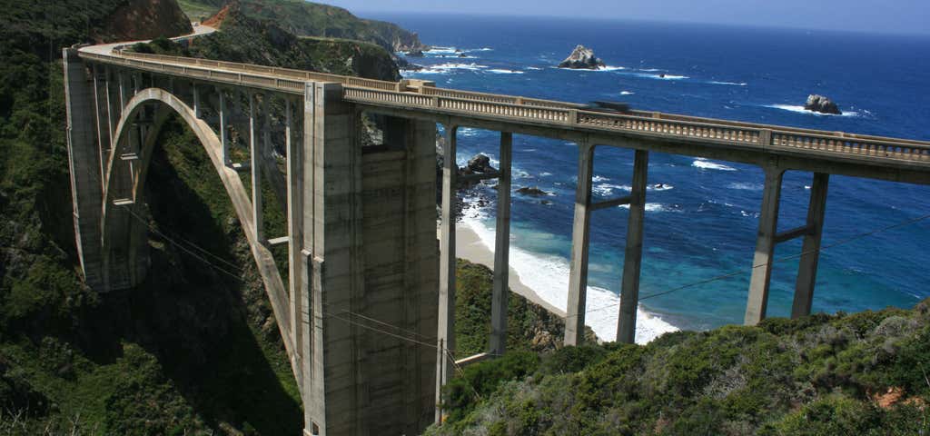
“The way to see California”
Stretching from sunny "So Cal" to the shady forests of the north, this coastal highway winds along some of the most spectacular ocean views in the U.S. The highway contains countless examples of the many intrinsic qualities that make a highway a National Scenic Byway--qualities like perfect views of ocean waves breaking on rocky shorelines and cliffs, dozens of historical landmarks like Spanish Missions and Spanish settlements, and limitless opportunities to participate in every kind of outdoor recreation imaginable. A traveler would have to travel numerous other byways spread across the nation to witness all the qualities contained on just this one byway. This should be no surprise considering the highway runs through some of America's most influential cities and most scenic landscape, including San Diego, Los Angeles, and San Francisco.
California's Pacific Coast Highway is one of the most unique highways in America, and also one of the longest. A traveler could deposit their car just north of the Mexican border and drive on maintained highway, much of it right on the coast, north to the Canadian Border. However, the actual Pacific Coast Highway is generally believed to begin as Route 1 at San Juan Capistrano South of Los Angeles, and end where Route 1 merges with Highway 101 at Leggett South of Eureka.
Be the first to add a review to the Pacific Coast Highway (South).
,path-8+EF4E22(idjvEtim_Vm%60%40fTz_%40t%5EjeItmCjpHr~%40vqBu%7CAlvGo%60TnsDvTvhDp_Bl%7CAs_%40jDqgClrAww%40dyDly%40vfKpSfpBwcA%7CmBu%7BCxuGgjOlyJc~%40x%7BBb_Dvd%40pyFloCxcArkGgrEryAomDrsIcEuKiiC%60%7DIepDbHokCz%7B%40ooAj_IkoEt%5D_bC_u%40%7BrDhbBq%7BJjlDbNdy%40si%40oE_xOrqAikHwLgeLzk%40uqHjqAkaCfaAovGav%40w%60%5CftDcmJ%7DbA%7B%60Gzj%40kfRdgGeuRx_IelL%60_%40_gDhkDg%7BD%7C%7DDwkNw_%40%7DxB%60~CkqIztHe%5BznHkbMheGgfDzfEqtLbgCcrLxy%40irOxvBiiEqnCcl%5ChEehXhfD%7BuGgQcbAbiCa%60FrlFu~E%60MsiBngNeCzvI%7DfAvvDe%7BIlAgqc%40heBejC~gDmyAzu%40alBfrKcoKrdHqwMzyAaoKnmI%7DyKb_BiwExkH_cH),url-https%3A%2F%2Frtcp.s3.amazonaws.com%2Fq%2F16(-117.736701965332,33.4938798886109)/auto/300x172@2x?access_token=pk.eyJ1Ijoicm9hZHRyaXBwZXJzIiwiYSI6ImNsdjQ5N2VtZDA2bW8ycW13ZHAxeGhjbjkifQ.UIccpoAxc7g3BAuK4s9vjg)
Pacific Coast Highway (South)
- 260mi
- 05h 32m
- $44