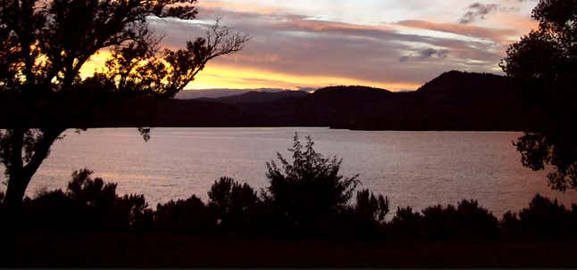
“offering scenic views of Unity Lake”
Unity Dam and Reservoir, major features of the Burnt River Project, are located below the confluence of Job Creek and the North, South, and Middle Forks of the Burnt River. The dam, located in BakerCounty of east-central Oregon, is 5 miles north of Unity and 40 miles southwest of Baker, Oregon. The dam is a rolled, zoned earthfill-type structure, 82 feet high above its foundation. The dam contains 254,000 cubic yards of earth and rock. The spillway, located at the right abutment, has a concrete-lined open channel controlled by two 24- by 16-foot radial gates with a top of gate elevation of 3820.0 and a spilliway crest elevation of 3804.0. Thedesign capacity of the spillway is 13,900 cubic feet per second at water surface elevation 3823.7. The outlet works, located through the right abutment, is controlled by two 2.75-foot square high pressureslide gates. The hydraulic capacity of the outlet works is 620 cubic feet per second at reservoir elevation of 3820.0.The 1991 reservoir survey measured a total storage capacity of 25,502 acre-feet and a surface area of 943 acres at the top of spillway gate elevation.

Be the first to add a review to the Unity Reservoir.
/-118.1866016,44.4512722,14/300x172@2x?access_token=pk.eyJ1Ijoicm9hZHRyaXBwZXJzIiwiYSI6ImNsczF1Y3RwcTA0ZmgycHAwbngweHlmbDAifQ.G6RP_RvWmMx8yNQSHb3PGQ)
Unity Reservoir
Hours
Problem with this listing? Let us know.
Has RV parking changed? Let us know.
-
Parking
-
Pets Allowed
-
Restrooms
-
Wifi
-
Wheelchair Accessible
-
Credit Cards Accepted
Nearby Hotels
Related Trip Guides
- Trip Guide
A road trip to filming locations featured in 'The Goonies'
- 6 Places
- 00:57
- 28 mi
- Trip Guide
The Ultimate Guide to Crater Lake National Park
- 15 Places
- Trip Guide
- Weekend
Pacific Coast Highway: Oregon - Washington
- 30 Places
- 17:36
- 670 mi
- Trip Guide
The top things to do on a U.S. Route 20 road trip
- 23 Places
- 60:25
- 3,576 mi