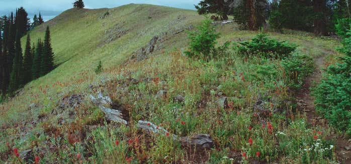
“1.4 million acres of diverse landscapes & plant landscapes”
The Umatilla National Forest, located in the Blue Mountains of southeast Washington and northeast Oregon, covers 1.4 million acres of diverse landscapes and plant communities. The Forest has some mountainous terrain, but most of the Forest consists of v-shaped valleys separated by narrow ridges or plateaus. The landscape also includes heavily timbered slopes, grassland ridges and benches, and bold basalt outcroppings. Elevations range from 1,600 to 8,000 feet above sea level. Changes in weather are common, but summers are generally warm and dry with cool evenings. Cold, snowy winters and mild temperatures during spring and fall can be expected. The Umatilla National Forest, in the Blue Mountains of northeast Oregon and southeast Washington, covers an area of 1.4 million acres (5,700 km²). In descending order of land area the forest is located in parts of Umatilla, Grant, Columbia, Morrow, Wallowa, Union, Garfield, Asotin, Wheeler, and Walla Walla counties. (Columbia, Garfield, Asotin, and Walla Walla counties are in Washington, while the rest are in Oregon.) More than three-quarters of the forest lies in the state of Oregon.[4] Forest headquarters are located in Pendleton, Oregon. There are local ranger district offices in Heppner and Ukiah in Oregon, and in Pomeroy and Walla Walla in Washington
Be the first to add a review to the Umatilla National Forest.
/-118.00223360154756,45.81599032353171,14/300x172@2x?access_token=pk.eyJ1Ijoicm9hZHRyaXBwZXJzIiwiYSI6ImNsczF1Y3RwcTA0ZmgycHAwbngweHlmbDAifQ.G6RP_RvWmMx8yNQSHb3PGQ)
Umatilla National Forest
Hours
Problem with this listing? Let us know.
Has RV parking changed? Let us know.
-
Parking
-
Pets Allowed
-
Restrooms
-
Wifi
-
Wheelchair Accessible
-
Credit Cards Accepted
Nearby Hotels
Related Trip Guides
A road trip to filming locations featured in 'The Goonies'
- 6 Places
- 00:57
- 28 mi
Pacific Coast Highway: Oregon - Washington
- 30 Places
- 17:36
- 670 mi
The top things to do on a U.S. Route 20 road trip
- 23 Places
- 60:25
- 3,576 mi

