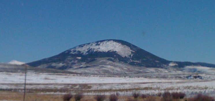
Tomichi Dome rises north of Colorado State Highway 50 west of Hot Springs Creek and south of Wanita Hot Springs Reservoir in the southeast quarter of Gunnison County, Colorado. It is situated within the Gunnison National Forest and is of a geologic formation called a laccolith. Laccolith formations are caused by igneous activity otherwise known as melting within the earth. Other laccoliths of the Gunnison Country are Mount Crested Butte, Gothic Mountain, Whetstone Mountain, Mount Axtel, Anthracite Range, Round Mountain, Carbon Peak, Beckwith Mountain, Marcellina Mountain and Mount Gunnison.
Read More >
Thanks!
Your Rating
1
2
3
4
5
Be the first to add a review to the Tomichi Dome.
/-106.52891918517106,38.48499439545022,14/300x172@2x?access_token=pk.eyJ1Ijoicm9hZHRyaXBwZXJzIiwiYSI6ImNsczF1Y3RwcTA0ZmgycHAwbngweHlmbDAifQ.G6RP_RvWmMx8yNQSHb3PGQ)
Tomichi Dome
Colorado
USA
Hours
Hours not available
Problem with this listing? Let us know.
Has RV parking changed? Let us know.
-
Parking
-
Pets Allowed
-
Restrooms
-
Wifi
-
Wheelchair Accessible
-
Credit Cards Accepted
Nearby Hotels
Almont,
Colorado
Salida,
Colorado
Gunnison,
Colorado
Gunnison,
Colorado
Gunnison,
Colorado
Related Trip Guides
- Trip Guide
Road trip to the filming locations of 'Dumb and Dumber'
- 8 Places
- 41:01
- 2,643 mi
- Trip Guide
The top things to do on a U.S. Route 20 road trip
- 23 Places
- 60:25
- 3,576 mi
- Trip Guide
Roadtrippers guide to mysterious Mesa Verde National Park
- 10 Places
- Trip Guide
The Ultimate Guide to Rocky Mountain National Park
- 15 Places
15132274