“the best approach to cross the North Platte River on the Oregon Trail”
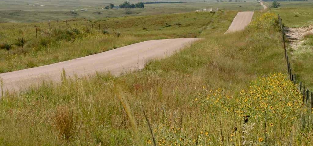
Near North Platte Nebraska, the Platte River splits into two major forks, with the South Platte running generally southwest towards Denver and the North Platte heading northwest towards Fort Laramie. Sooner or later, the emigrants were forced to cross the South Platte in order to reach and follow the North Platte towards South Pass. Several crossing sites were used, but the Upper Crossing was the most important because it led directly to Ash Hollow, the best approach to the North Platte River. California Hill, encountered immediately after crossing the South Platte, was the first major grade faced by the emigrants. This necessitated a climb of 240 feet in just over 1½ miles in order to reach the plateau between the North and South Platte Rivers. Imposing trail ruts are still plainly visible most of the way up the hill. The Nebraska State Historical Society, who owns the resource, invites you to get out of your car and walk in the footsteps of the pioneers. The panoramic views back toward California Crossing are spectacular.

We found it! Once you are in Brule, take Lincoln Highway/ Route 30 West and there will be a sign at Highway West M N. Do NOT try and drive up the hill... We got stuck and had to call a tow truck!
Get off the exit your GPS takes you too. I can't remember the exit #. Go towards the rail road tracks the cross them. You will come to a literal ghost town. Go to Lincoln Highway go west. Around 4-5 miles down on the right is the marker. It's hard to find w Apple maps. Do not drive up the hill unless you have 4 wheel drive. We drove up w my truck. What a view and definitely worth the stop.
Could not find this. Brule is a ghost town!

Follow the directions as listed here earlier; 4.5 miles west of Brule on the state highway.
Travel up the “minimum maintenance road” is easy in a 4 wheel drive vehicle. If you want to wear out the kids, walk it.

It was a fun little stop for cooped up kids in the car. The details on the trail weren’t quite what I expected, but I’ve never done any part of the Oregon/California trail before. Nothin g beats free adventure on a road trip!

Also! You can see the ruts from satellite view on Google Maps
Pretty cool! Little bit of a hike up the hill, so it's not a super quick stop. The ground is silt, so beware of even the slightest bit of moisture on the ground. I echo others -- only drive if you have 4wd. It's located way down on the highway. If you zoom in on your map to where it says "Megeath," it's basically there. That gives you an idea of how far down it is.
Be the first to add a review to the California Hill.
/-101.8880234,41.092927,14/300x172@2x?access_token=pk.eyJ1Ijoicm9hZHRyaXBwZXJzIiwiYSI6ImNsczF1Y3RwcTA0ZmgycHAwbngweHlmbDAifQ.G6RP_RvWmMx8yNQSHb3PGQ)
California Hill
Hours
Problem with this listing? Let us know.
Has RV parking changed? Let us know.
-
Parking
-
Pets Allowed
-
Restrooms
-
Wifi
-
Wheelchair Accessible
-
Credit Cards Accepted
Nearby Hotels
Related Trip Guides
- Trip Guide
- 1 Week
Road Trip Down US 83: The Road to Nowhere
- 36 Places
- 34:43
- 1,869 mi
- Trip Guide
The top things to do on a U.S. Route 20 road trip
- 23 Places
- 60:25
- 3,576 mi
- Trip Guide
The top things to do on an I-80 road trip
- 35 Places
- 53:41
- 3,194 mi
- Trip Guide
Road trip along the Oregon Trail: A journey through history
- 31 Places
- 36:24
- 2,114 mi