“take the scenic boardwalk & discover the history of the Thunder Bay River”
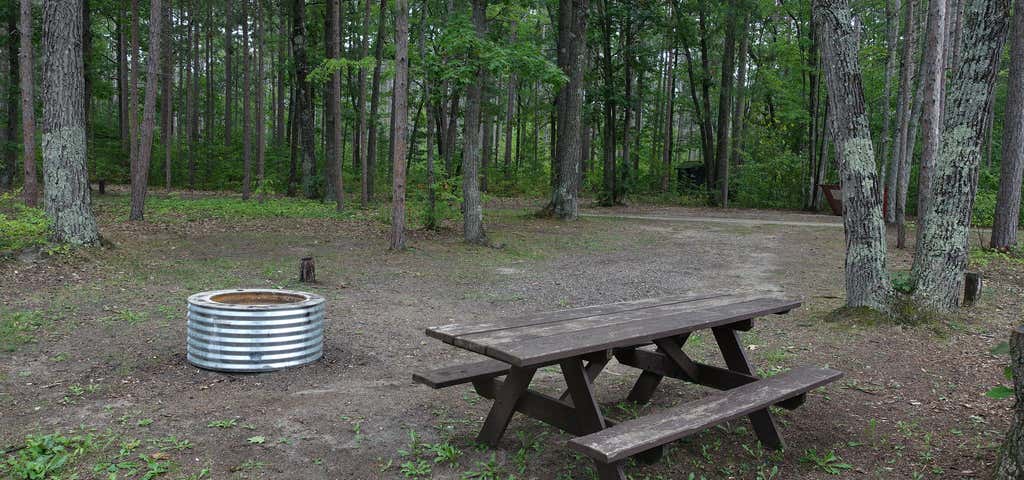
The Thunder Bay River is a 75.4-mile-long (121.3 km)river in the U.S. state of Michigan. It drains much of Alpena County and Montmorency County, and a small portion of Oscoda County, into Thunder Bay on the eastern side of northern Michigan. The mouth of the river is in the heart of downtown Alpena and is guarded by the Alpena Light Station. Unlike many of Michigan's rivers, the Thunder Bay River drops considerably from its headwaters in southwestern Montmorency County to Lake Huron. A hill near the headwaters northeast of Lewiston is 1,270 feet (390 m) above sea level and 689 feet (210 m) above lake level. A former whitewater stretch northwest of Alpena, the "Long Rapids", carried the river down from the northern Michigan plateau to Thunder Bay. The rapids have since been drowned under Lake Winyah, also known as Seven Mile Pond (see map in external links hereafter), a hydroelectric reservoir created by the Norway Dam (also known as Seven Mile Dam). Much of the middle and upper reaches of the Thunder Bay River flow through the Mackinaw State Forest, which is a large swathe of northeastern Michigan that, after logging was completed in the 1910s, reverted to the state for unpaid property taxes. The state forest contains large numbers of aspen and birch trees, pulpwood trees typical of second-growth Michigan forests.The largest reservoir in the Thunder Bay River basin, the 8,500-acre (3,400 ha) Fletcher Pond (also called Fletcher Floodwaters) in western Alpena County, began to fill in 1932. It is noted for having the second largest population of ospreys in the Midwest. As of 2006, pond riparian property owners were actively trying to counter an exotic infestation of Eurasian watermilfoil. 10 sites for tent and small trailer use. Located along the Thunder Bay River providing water access to every campsite. Small boat launch on the campground. Wah-Wah-Tas-See Pathway access. Rustic campground includes vault toilets and potable water from well hand pump. Sites available on a first-come, first-serve basis. No reservations. Check with State Forest Campground Manager for seasonal availability.
Be the first to add a review to the Thunder Bay River State Forest Campground.
/-83.5565200439326,45.019337414479025,14/300x172@2x?access_token=pk.eyJ1Ijoicm9hZHRyaXBwZXJzIiwiYSI6ImNsczF1Y3RwcTA0ZmgycHAwbngweHlmbDAifQ.G6RP_RvWmMx8yNQSHb3PGQ)
Thunder Bay River State Forest Campground
Hours
Problem with this listing? Let us know.
Has RV parking changed? Let us know.
-
Parking
-
Pets Allowed
-
Restrooms
-
Wifi
-
Wheelchair Accessible
-
Credit Cards Accepted
- Affiliation
- Other public land (TVA, DOD, county parks with campgrounds)
- Lowest Nightly Rate
- 15.0
- Max Stay
- 14
- Season End
- November
- Season Start
- May
- Sites Count
- 10
- Standard Tent Sites Count
- 3
-
Paved Sites
-
Fifty Amp
-
Full Hookup
-
Rec Facilities
-
Pull Through
-
Tent Sites
-
Dump Station
-
Big Rigs
-
Open Seasonally
-
Age Restricted
-
Boondock
-
Cabin Sites
-
Dispersed Sites
-
Firewood
-
Fulltime Residents
-
Group Tent Sites
-
Laundry
-
Mobile Homes
-
Permit Required
-
Potable Water
-
Propane
-
Public Water
-
Pull Through RV Sites
-
Reservations
-
Sewer Hookup
-
Showers
-
Sites
-
Standard Tent Sites
-
Water Hookup
Campground, Restrooms
Nearby Hotels
Related Trip Guides
- Trip Guide
The Great Northern is a 3,600 mile, cross-country odyssey
- 57 Places
- 69:15
- 3,565 mi
- Trip Guide
Gone But Not Forgotten: Former National Parks
- 7 Places
- Trip Guide
The top things to do on a Tunnel of Trees road trip
- 12 Places
- 00:51
- 31 mi
- Trip Guide
The top things to do on an I-75 road trip
- 34 Places
- 31:05
- 1,933 mi