Remove Ads

CA-2017: SF -> DSM

  • 55
  • 60:22
  • 3,159 mi
  • $521
Take This Trip

Created by Afan - January 20th 2017

1
4mi 00h 11m
Photo of Fort Point National Historic Site
3.6

Bicycle Route 202, San Francisco, CA, US

Fort Point National Historic Site

1
2
3mi 00h 08m
Photo of Battery Spencer
4.8

Conzelman Road, Sausalito, CA, US

Battery Spencer

2
3
20mi 00h 38m
Photo of Stinson Beach
4.5

3416 California 1, Stinson Beach, CA, US

Stinson Beach

3
4
43mi 01h 06m
Photo of Potter Schoolhouse (From Hitchcock's "The Birds")
4.0

17110 Bodega Ln, Bodega, CA, US

Potter Schoolhouse (From Hitchcock's "The Birds")

4
5
16mi 00h 26m

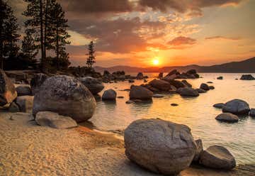
Jenner, California, United States

5
7
44mi 01h 20m

67402 Drive-Thru Tree Rd., Leggett, CA, US

Chandelier Drive-Thru Tree

7
8
36mi 00h 42m

6831 Avenue of the Giants, Miranda, CA, US

Avenue of the Giants

8
9
236mi 04h 19m
Photo of California Auto Museum
3.7

2200 Front St, Sacramento, CA, US

California Auto Museum

9
10
43mi 00h 43m

524 Main St, Placerville, CA, US

Fountain-Tallman Museum

10
11
18mi 00h 19m

Us Highway 50, Pollock Pines, CA, US

Bridal Veil Falls

11
12
47mi 01h 01m
Photo of Vikingsholm
4.5

Hwy 89 at Emerald Bay State Park, South Lake Tahoe, CA, US

Vikingsholm

12
13
1mi 00h 02m

9999 Emerald Bay Rd, South Lake Tahoe, CA, US

Vikingsholm Castle

13
14
3mi 00h 05m
Photo of Lake Tahoe
4.5

CA, US

Lake Tahoe

14
15
3mi 00h 04m

4 Emerald Bay Rd, South Lake Tahoe, CA, US

Camp Richardson Corral

15
16
14mi 00h 21m
Photo of Sugar Pine Point State Park
4.5

West Lake Blvd., Tahoma, CA, US

Sugar Pine Point State Park

16
17
29mi 00h 50m
Photo of Sand Harbor at Lake Tahoe
4.1

Tahoe Blvd, Incline Village, NV, US

Sand Harbor at Lake Tahoe

17
18
20mi 00h 27m
Photo of Nevada State Capitol
4.0

101 North Carson St, Carson City, NV, US

Nevada State Capitol

18
19
87mi 01h 35m
Photo of Sand Mountain Recreation Area
3.3

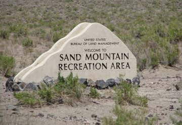
25 miles East of Fallon on Highway 50. Turn left onto paved access road, Churchill, NV, US

Sand Mountain Recreation Area

19